Being driven around is not our ideal way to travel. But Flores Island, with its one National Road and many smaller off shoot roads to attractions and villages, has only a few motor driven options. Scooters are obviously the first choice among locals, but we’re not scooter or motorcycle competent and these roads would be a bad place to learn or practice many folks told us. So, drivers and cars it was. Yes, there are buses, but with the bus trips you can’t stop and enjoy the view or take photos, and apparently they go as fast as they can which makes for a bumpy ride. Not good for anyone prone to motion sickness. We did spot a solo bike tourist but didn’t get to chat.
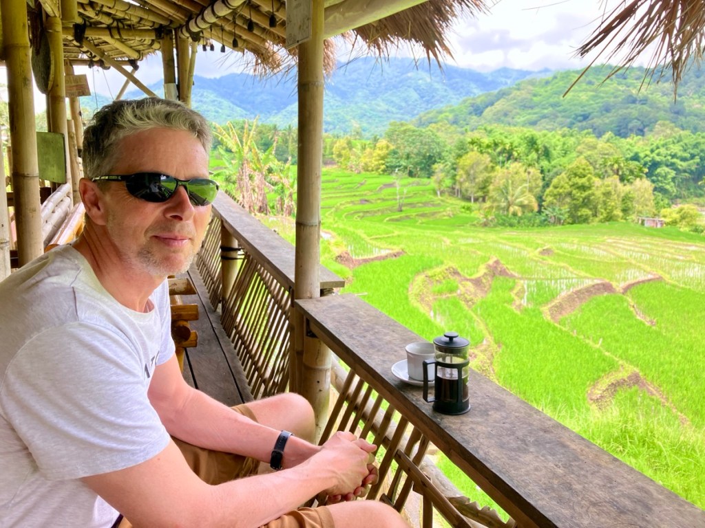
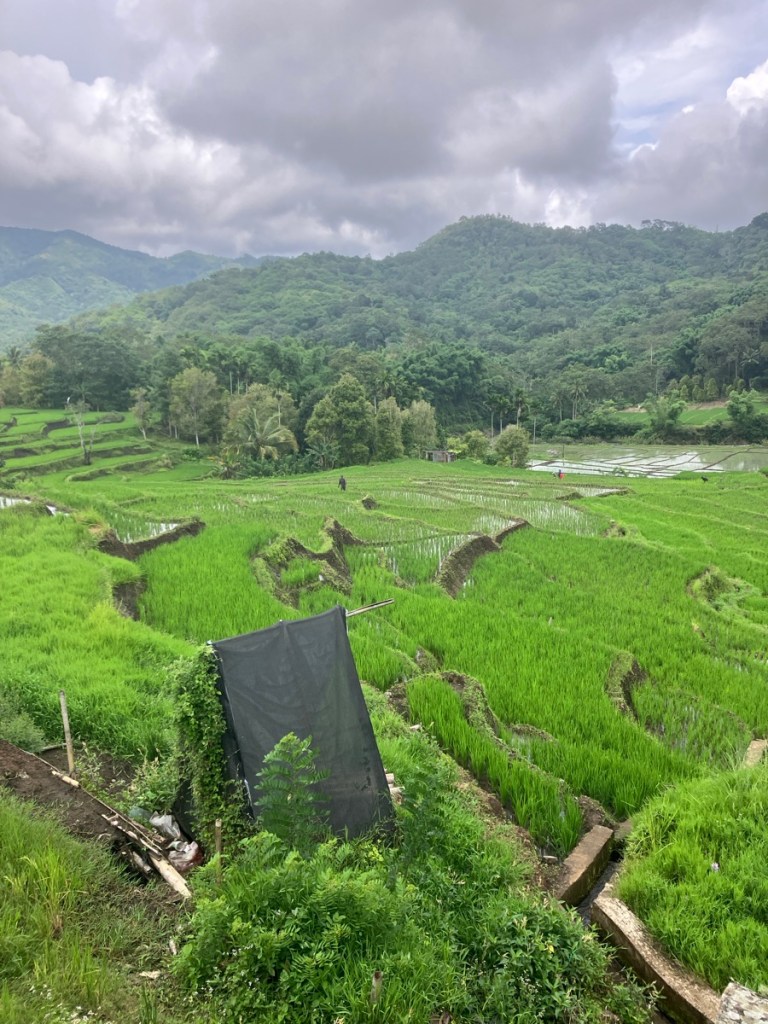
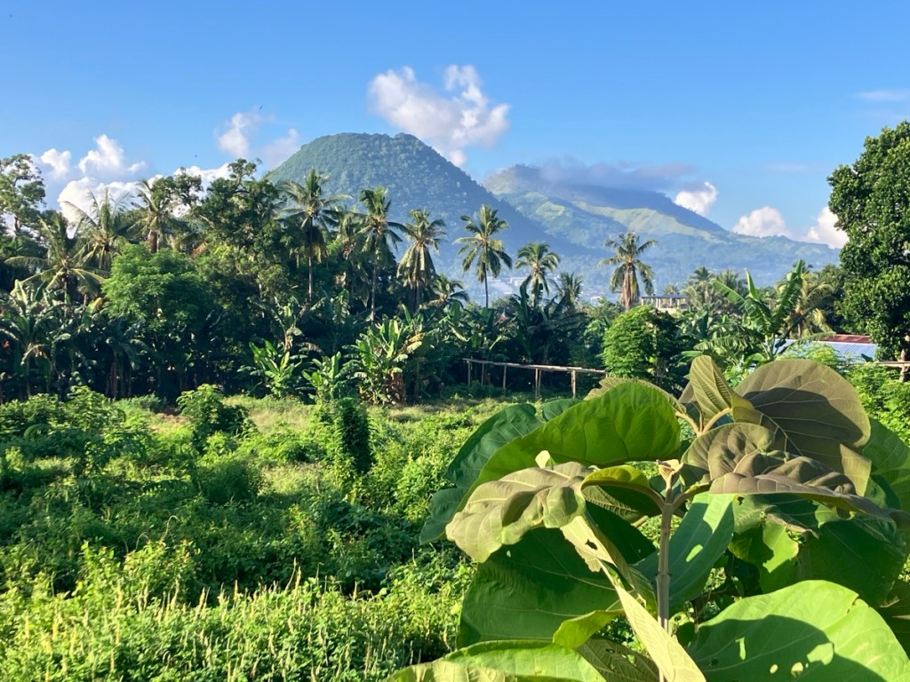
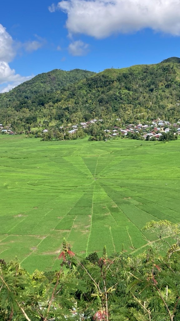
Indonesia is the world’s third largest rice producer. Rainy season means plenty of water and so much green!
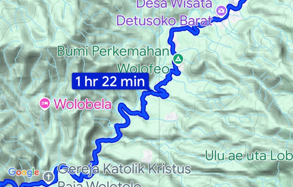
From Moni to our next overnight stay, Ende, the journey shows up on Google maps as 1 hour and 22 minutes driving time. With a few stops along the way to snap photos and have a coffee it was about 2 hours and 30 minutes. Our second driver, hired just for the day, was named Nopi, and he was a lovely calm driver. He got us to Ende in time for a late lunch.
A few of the twists and turns of the National Road. This keeps speed down for sure.On the outskirts of Ende. The steep volcanic mountains are so dramatic.
Would we be able to handle days of being driven? We are so used to traveling on our own and at our own pace. Add in the heat at the stays near the coast and you have a recipe for cranky travelers who aren’t getting enough exercise.
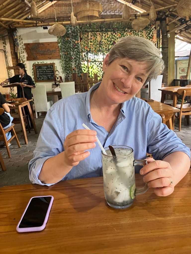
Ende is a long volcanic slope of a town. 86f/30c isn’t too hot, but the 80% humidity gets you.A cold drink in the shaded PariKoro Resto. This great lunch stop was only a 12 minute walk from our hotel.
Ende is not a good walking town. The sun and heat, the long slopes, and the noise from traffic and scooters combine for an unpleasant experience. Until Rich got us off the main roads with a little help from MapsMe.
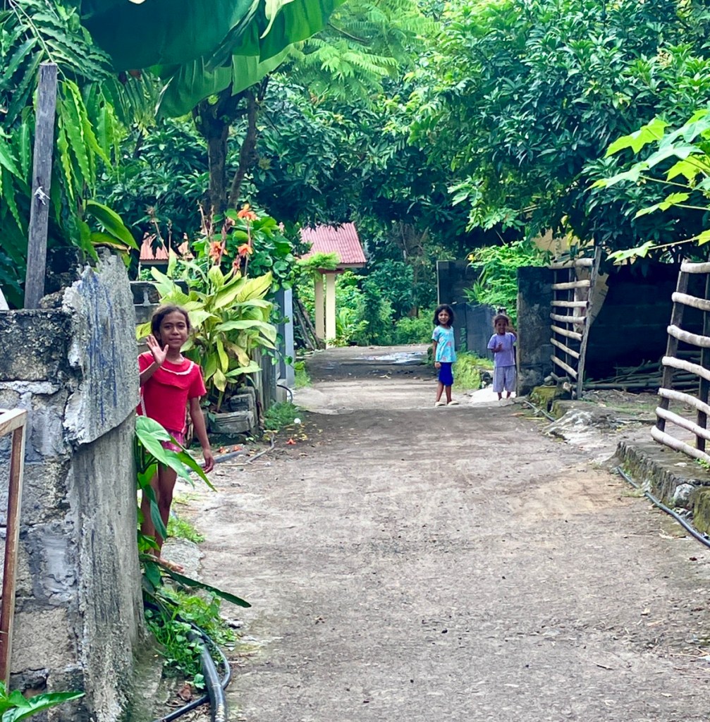
These young women were practicing a dance and chased us down for photos.And then I got a photo of the photographers.The shady small streets were scooters and pedestrian only. The kids came out to wave hello.
After just one night in Ende we were picked up by our third and final driver, Nyoman, who would take us all the way back to Labuan Bajo over four more days of driving and stops for lunch and to see sights, and one two night stay in Bajawa.
A view from town of your friendly neighborhood volcano. Flores has numerous volcanoes, 14 of which are considered active.First stop, the optical shop so Rich could get his reading glasses fixed.
A few things made the driving not just tolerable but fun. First was of course nice, safe, calm drivers. Second was saying no to air conditioning and just leaving the windows down. Our first driver started this practice, he asked if we would be ok with no AC. Well, we’ll try we said. What a difference it made to be able to see and be seen by the locals. With the tinted windows up they couldn’t see us, and we couldn’t make eye contact, wave and say hello. And we said hello or selamat pagi (good morning) a lot! The kids call out Bulay! when they see a foreigner, or yell Hello Mister! Traveling at 30mph or less because of the twisting roads we got to see a lot. And the experience of driving along seeing the locals and the amazing jungle was unlike any other trip we’ve made.
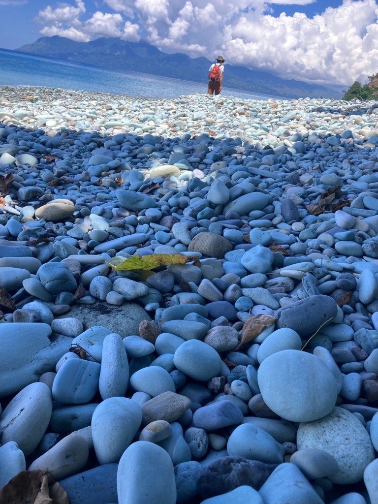
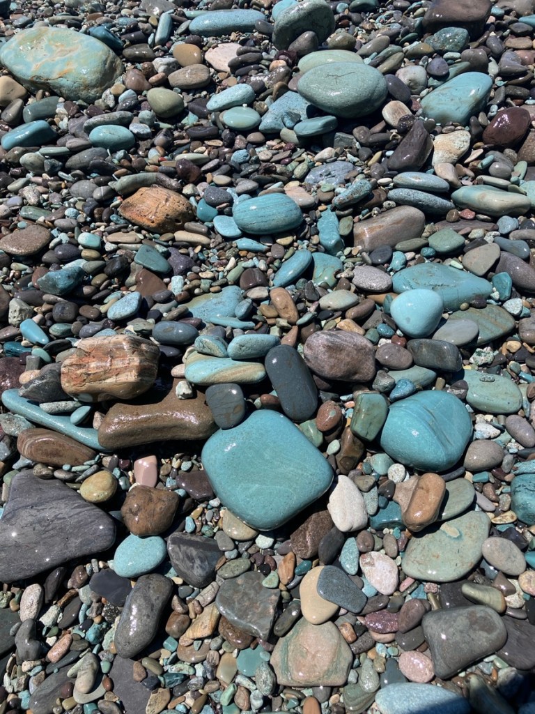
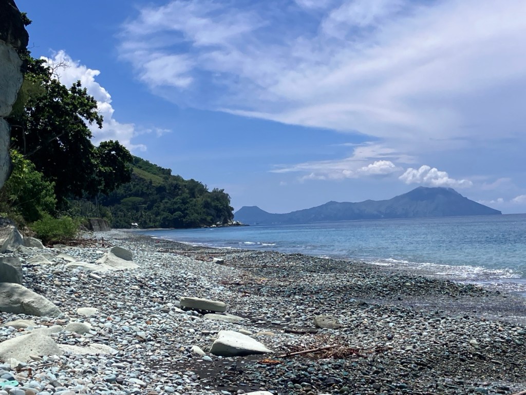
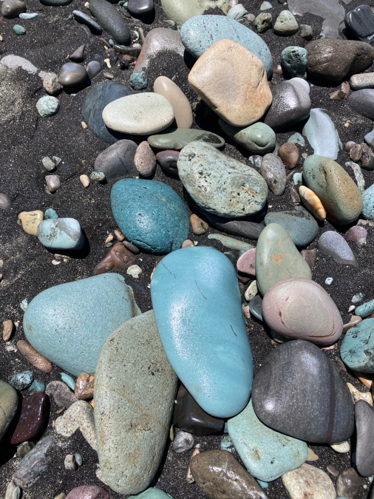
Lunch stop at Blue Stone Beach. I love my puddle of shade.When dry the stones are not so blue, more gray.But when the water washes over them! Shade break and time for viewing dramatic clouds.A view back towards Ende and some volcanoes.The blue is most likely due to volcanic minerals such as sulphides and rock-forming feldspar. So thank you for that, volcanoes.Still not blasé about volcanic mountains.
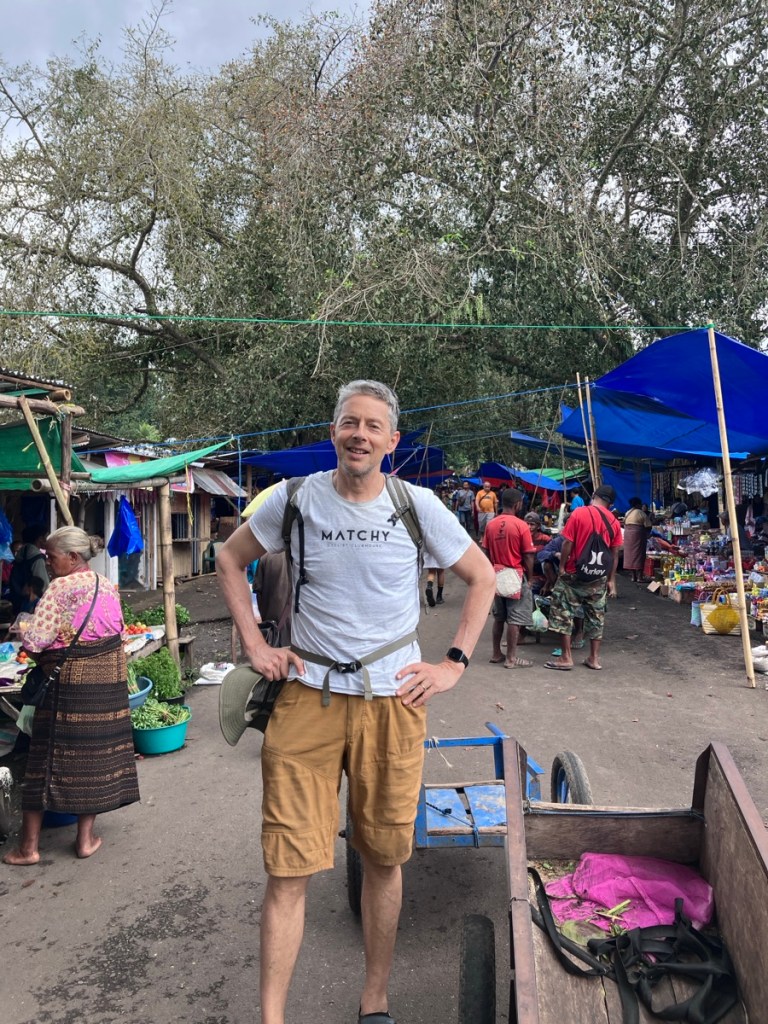
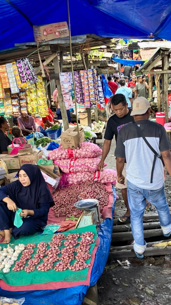
Nyoman asked if we wanted to stop by the Mangeruda Hot Springs, and although hot water didn’t sound too appealing we said yes. But first a stop at a huge regional market.
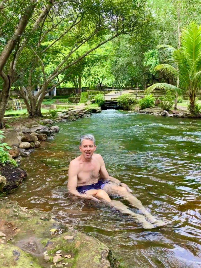
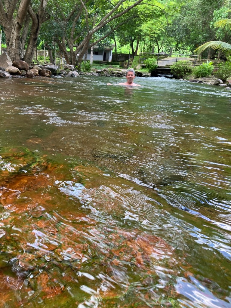
The weekly market was in full swing so Nyoman dropped us off and we walked through.We only stayed on the primary street, but the market stretched back quite a way.So many greens for sale. Without our driver as a guide we didn’t feel as welcomed at this market. We made one pass through and headed on.Mangeruda Hot Springs and Rich heating up. Thank you again volcanoes.Rich says the water was about 95-100f/35-37c.There was also a big, deeper and cooler pool, with rather sharp stones in the bottom.
After Rich had a good soak and I took photos we headed to Bajawa, where we had a two night stay booked at the Bajawa Roo Hotel. Bajawa was our favorite stop on the drive across Flores. Part of that was the town, it was cool at 3,900 feet/1,200 m above sea level – we got to wear our down jackets and long trousers – which made them not ridiculous to bring along. The Bajawa Roo Hotel was a fantastic travelers hotel run by a super friendly and helpful couple, Sri and Moses.
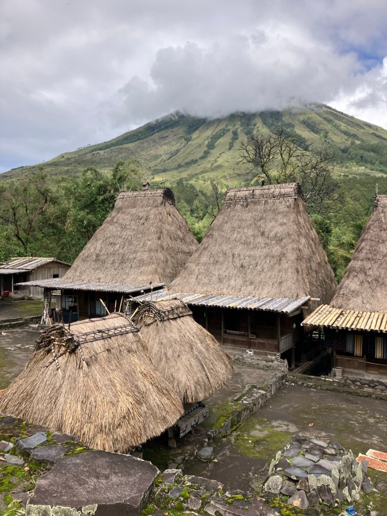
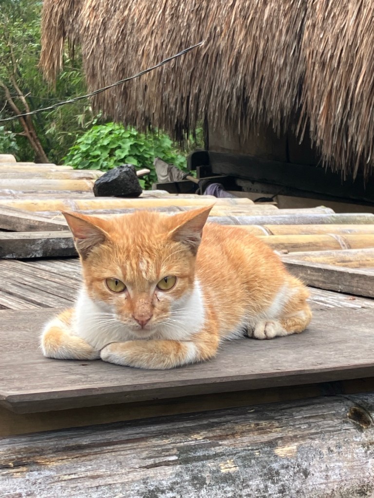
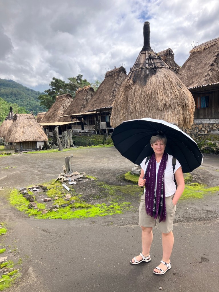
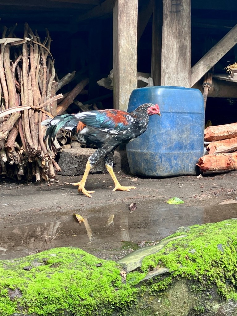
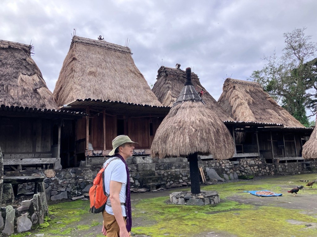
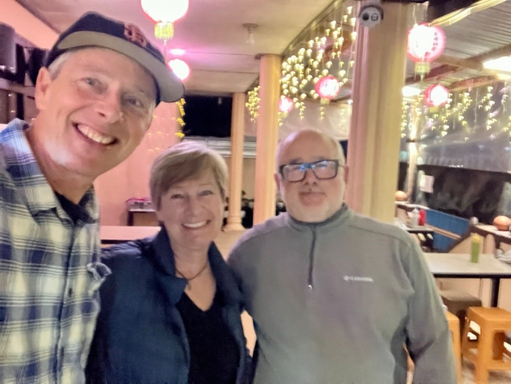
Rich and Martin, who was from Poland and a surfer.Volcano view from our terrace.Down jacket finally came in handy!We were happy to walk to dinner at a Chinese restaurant nearby. Nyoman offered to drive us to and from dinner but we always prefer a walk.Bena Traditional Village was our first stop of our non travel day. Kitty greeter. They look less than delighted to see us.Me and my portable shade.What a colorful chicken. It can feel awkward to wander around the village, but the scarfs we are wearing show that we have registered and made a donation. And I always buy something- this time it was traditional textile.Wood carving decorating the buildings.Toilet buildings were communal.And cats were plentiful.View spot, that’s the ocean out there.
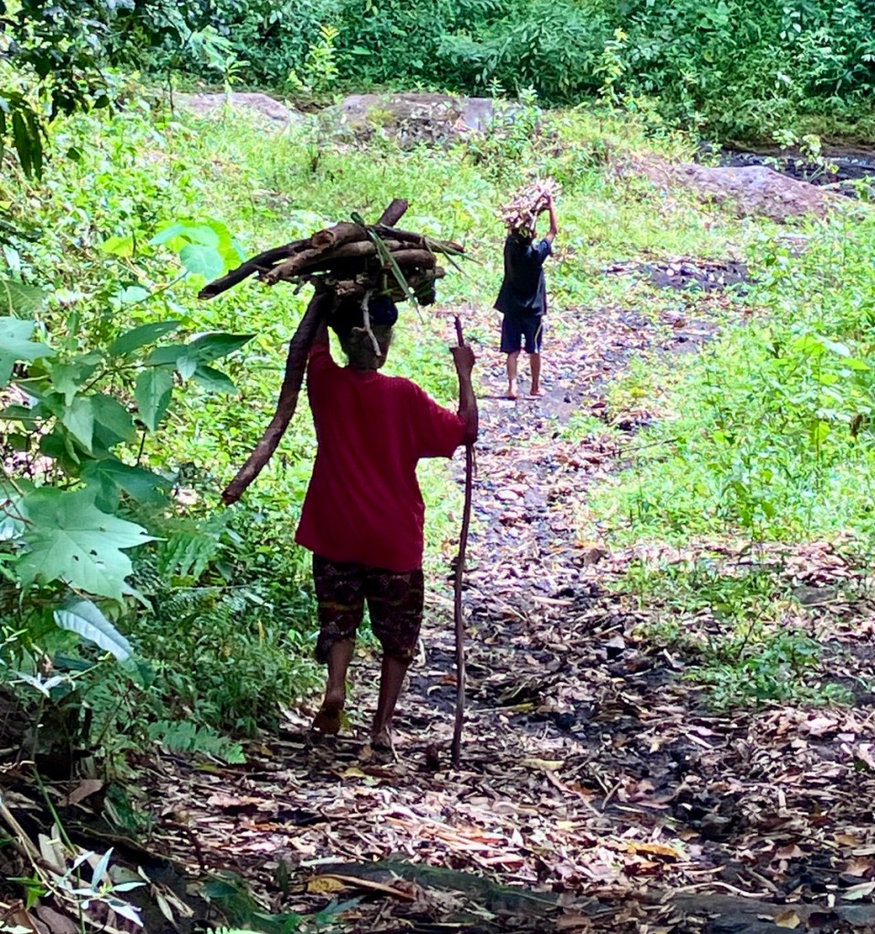
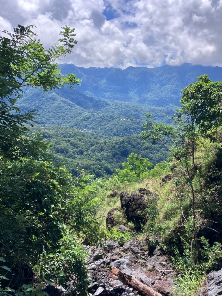
Nyoman showed us the trail to the next traditional village, Tololela. It was an hour walk through stunning jungle. We would meet up with Nyoman again after walking down the very steep road from Tololela.
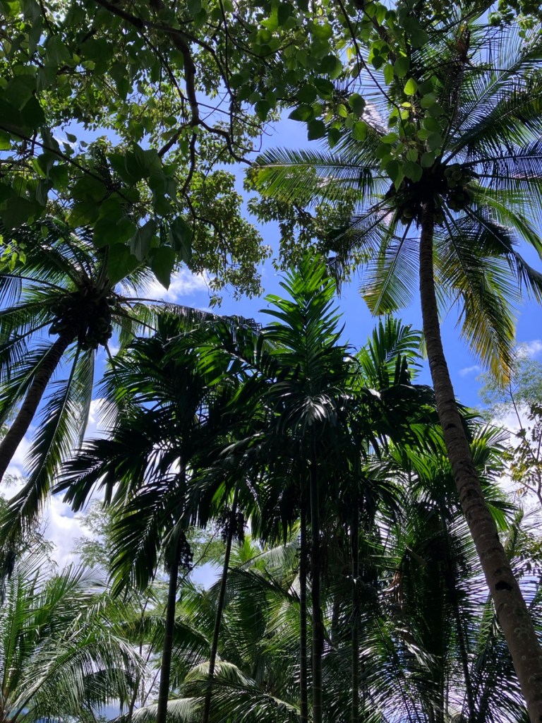
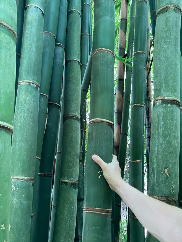
The roads are in a constant state of repair, especially in rainy season. Hati hati translates as be careful! A woman and a child carrying firewood back to the village.It’s not easy to navigate the jungle with an umbrella. But I did.Almost hidden by ferns.So much intact jungle. Such steep slopes.Palms reaching for the sky.And so much bamboo. Rich added for scale. The bamboo plants were massive.A mixed jungle. No monoculture here.Tololela Village. Again, you stop by the first building on the right and make a donation. It helps the villages stay viable in these modern times.Deep overhangs for shade and rain protection.Wood carvings. I’m not sure why a horse, we didn’t see any.Horns and jawbones.Not just cats, cute dogs too.I was glad that we visited both villages, they had different feelings to them, and I noticed more details at the second village.A chicken strutting past drying candlenuts. The sun was so hot we could hear the nuts sizzling. The nut is used in cooking, and the oil for hair products or illumination.
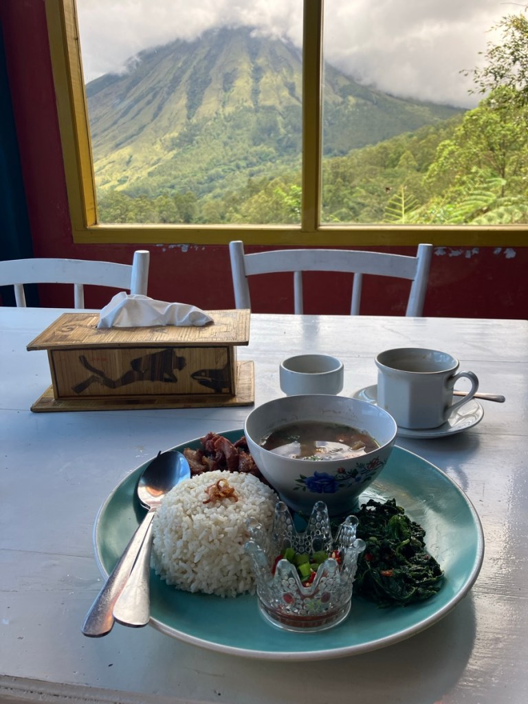
We headed down the very very steep road, marveling at the scooters taking the sharp turns loaded with several people, met up with Nyoman, and headed back up the mountains for a view restaurant for lunch.
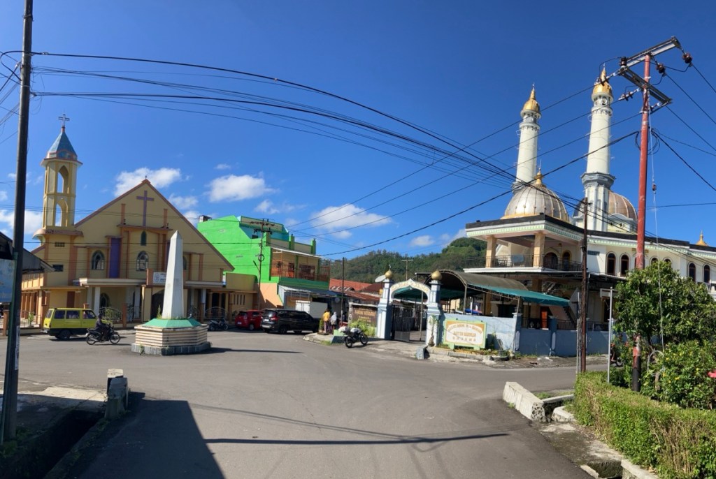
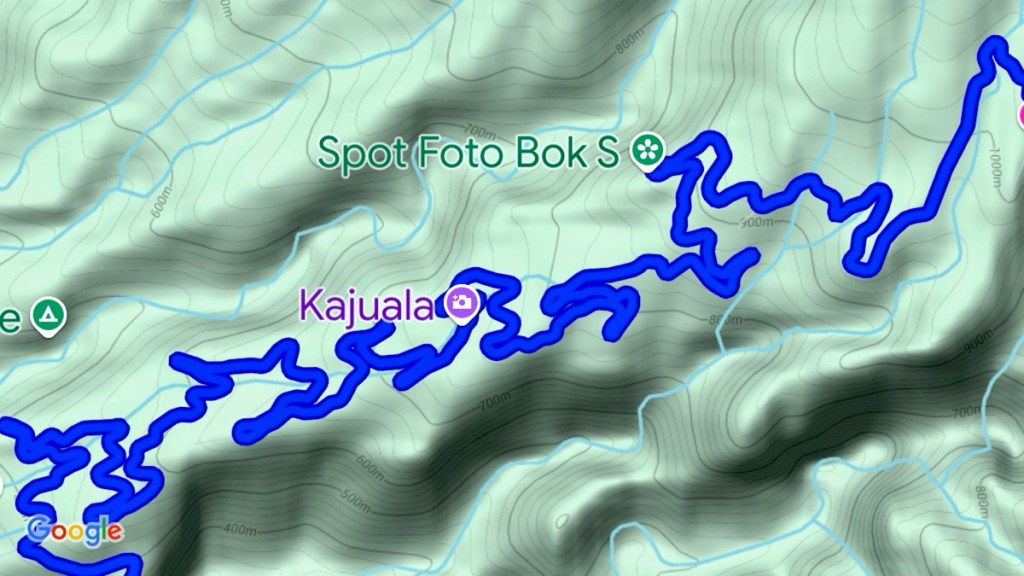
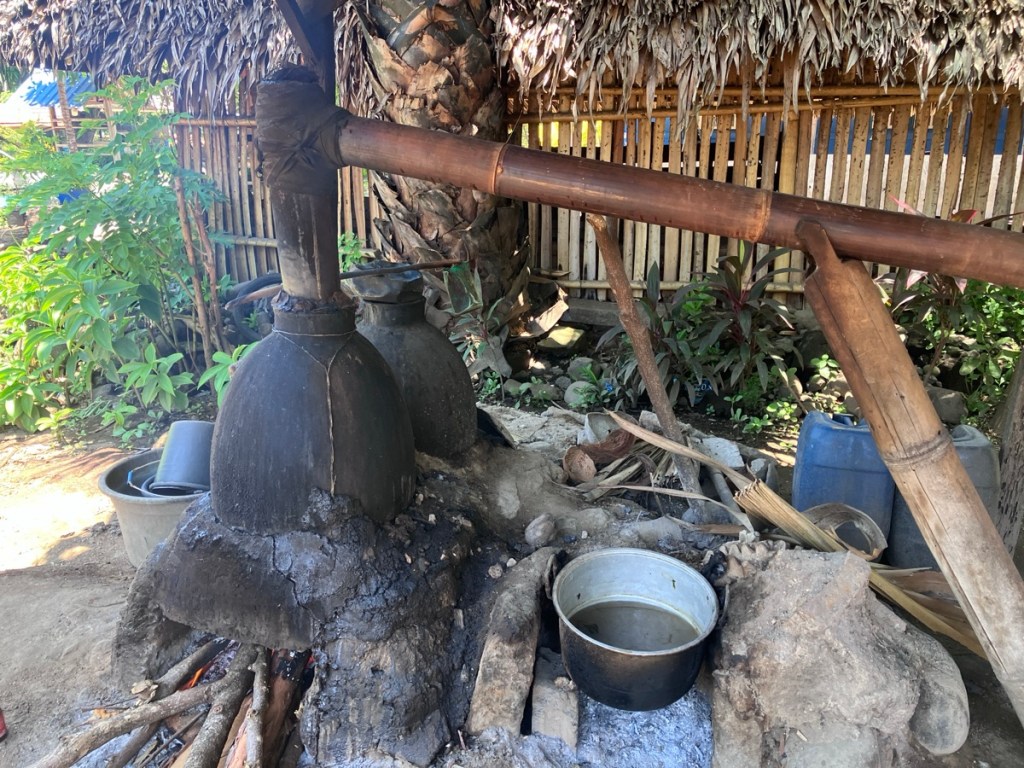
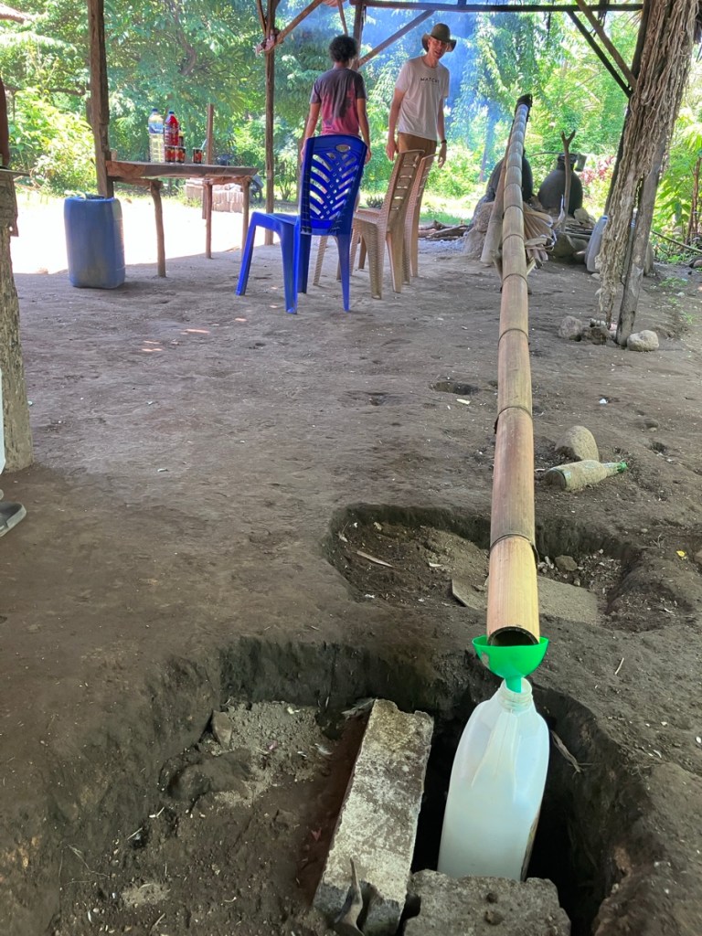
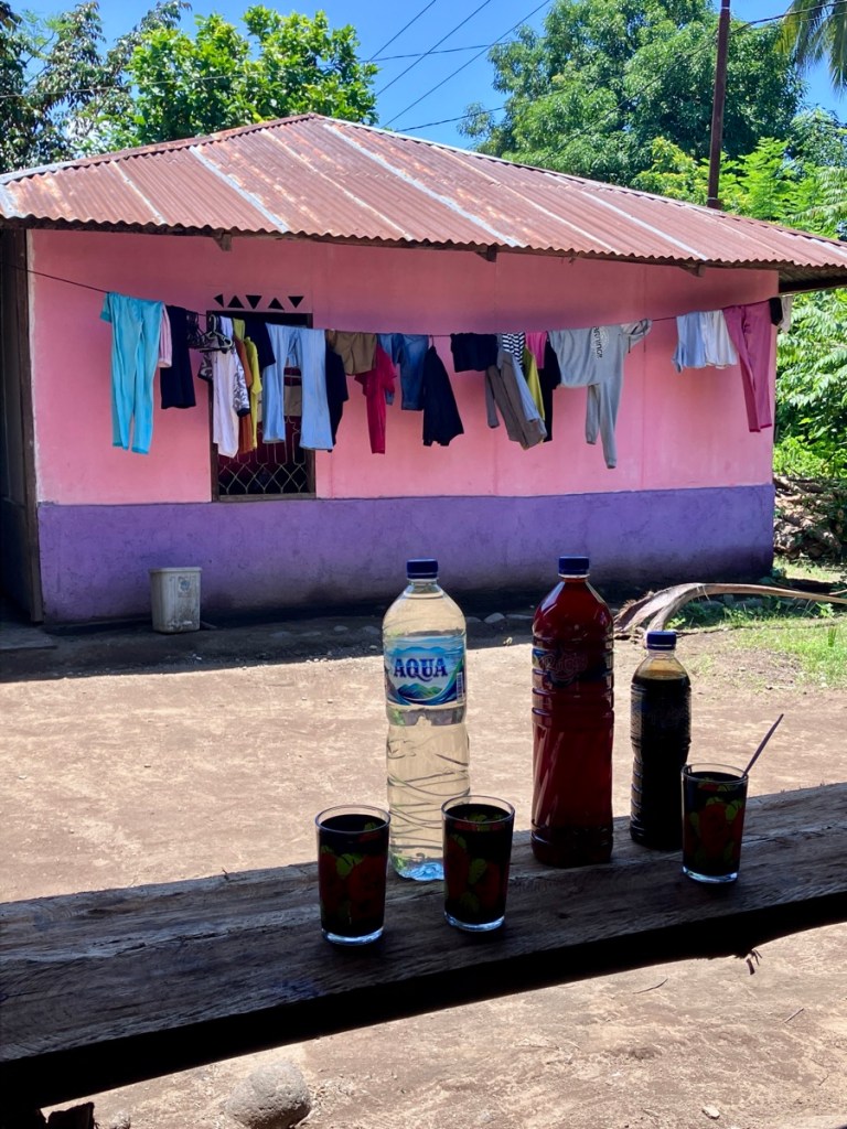
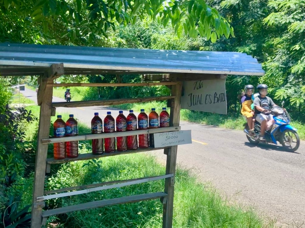
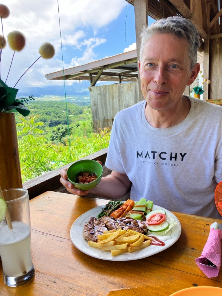
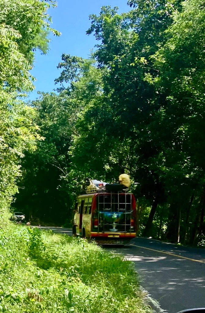
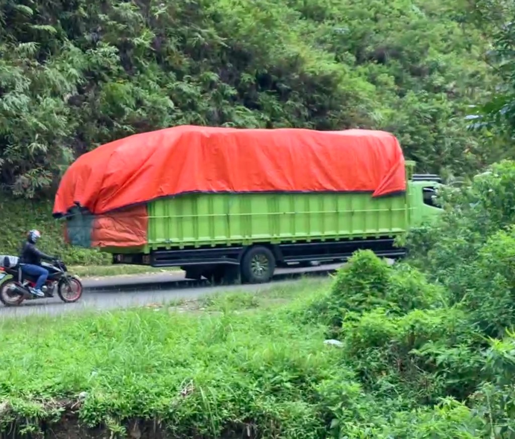
Volcano view at Heaven’s Door Bar & Restaurant.Rich finally got to try the smoked barbecued pork.Dinner with a fellow traveler, Ramon from Catalonia. Sunrise on another travel day.But first a walk into town. Must navigate puppy lane without scooping one up. Bajawa was setting up for a festival and folks were using the walking track in the park.A Catholic Church and a Muslim Mosque across the street from each other. Ramadan was starting in a few days.Goodbye Bajawa! Hello more volcanoes. Nyoman and I stayed in the car while Rich snapped photos.When you look at the route, the twists and turns, it’s really amazing this road exists. And it does suffer from land slides and fallen trees, but it’s the one cross island connection, so when it’s blocked there is a fast effort to reopen it.Our first stop on this almost four hour drive was a Moke home distillery. An alcoholic beverage made from palm tree fruits.A rather simple distillery after the harvesting of the sap from the fruits.The tasting room. Left is the clear very high proof Moke, middle is the same but flavored with spices and sugar, and right is the thick sap condensed down to sugars.The owner and distiller. We are on the coast again and it was hot. Her retail stand on the side of the road. The drivers always know the good lunch stops. Tuna steak, veggies, fries and plenty of sambal.Passed by a local bus. There were usually a few guys riding on the top, and some poultry hanging from the back rack.One night Ruteng at the Ara Garden Inn, 1,100 m, 3,800 ft elevation meant the jackets came out again.An early breakfast so we could get on the road – one final day of driving!A stop at the lingko (circle) rice fields and Rich with our two little guides, 12 and 14 years old. Similar to the traditional villages you make a donation and then are guided up to the viewpoint.Sheno and Clifford explained that the villages which share the field originally each had a pie shaped plot, divided further by families – which makes a spiderweb formation.The National Road has good asphalt, and is shared with a lot of scooters, some cars, and big trucks hauling manufactured goods from other islands and mostly agricultural goods from Flores.
From Ruteng to Labuan Bajo the road climbs over passes and down to the coast twice. The difference in heat is very noticeable. When we finally reached Labuan Bajo Nyoman even shook his head and said “So hot.” He is from Moni which is at 700m/2,200 feet so a bit cooler than the coast. I was pleased to hear that even a local found the weather hot.
The happy travelers in Labuan Bajo again, after 8 days exploring the island.
Crossing the island at 30 mph (or so) was amazing. That is a slow enough speed to leave the windows down and not be wind blown. It’s the right speed to spot things and ask to stop. The jungle goes by slowly enough that you can marvel at the mix of trees and plants. See the cows grazing at the sides of the roads. Laugh at the dogs asleep in the middle of the road (drivers always carefully avoid the dogs). It may not be our favorite mode of travel, but for this trip our more car decision was the right one. Next up: Pirate Island!
And a map! Hearts are where we spent the night.And a larger map. The hearts across Java are from a trip in 2017/2018. The blue dot is us in Dalat, Vietnam right now.
After decades of living and working in wonderful San Francisco we gave it all up to travel the world. Not owning a car allowed us to save money and live hyper-locally. Now we’re living around the globe. Follow along to see where we are and what cats I manage to pet.
View all posts by cbink
4 thoughts on “Crossing Flores Island at 30 mph.”
Thanks for sharing interesting stories and many beautiful/precious photos about Flores Island.
at 666 klms across, what are your thoughts on roads if someone wanted to walk across this beautiful island?
i am not finding much about the roads online unfortunately
thanks
Hi Darren, Rich and I just talked about it and we agree it’s doable, but might be pretty tough and possibly unpleasant at times. There are loads of locals walking short/medium distances on the roads to villages, and there aren’t a lot of cars once you’re away from bigger places, but it’s on road walking. On the upside you would be a novelty and get to interact with locals a lot! And folks are super friendly and would help you find a local mini bus if a section go to be too much. There are probably quite a few trails but finding them is a challenge. It’s hard to describe how twisty and steep the roads are. And how hot and humid it is. But if you do it – wow! What an adventure! Good luck and let us know how it was!


Thanks for sharing interesting stories and many beautiful/precious photos about Flores Island.
Thank you for reading and I’m glad you enjoyed the photos. It’s a beautiful place.
really enjoyed the photos & notes, thank you
at 666 klms across, what are your thoughts on roads if someone wanted to walk across this beautiful island?
i am not finding much about the roads online unfortunately
thanks
Hi Darren, Rich and I just talked about it and we agree it’s doable, but might be pretty tough and possibly unpleasant at times. There are loads of locals walking short/medium distances on the roads to villages, and there aren’t a lot of cars once you’re away from bigger places, but it’s on road walking. On the upside you would be a novelty and get to interact with locals a lot! And folks are super friendly and would help you find a local mini bus if a section go to be too much. There are probably quite a few trails but finding them is a challenge. It’s hard to describe how twisty and steep the roads are. And how hot and humid it is. But if you do it – wow! What an adventure! Good luck and let us know how it was!