When we end a bike trip nothing feels better than taking a nice break at our wonderful generous friends’ house in the Vallée Verte, France. We shop for food and cook in every day instead of searching for open grocery stores and restaurants. We have leisurely mornings and afternoon naps.
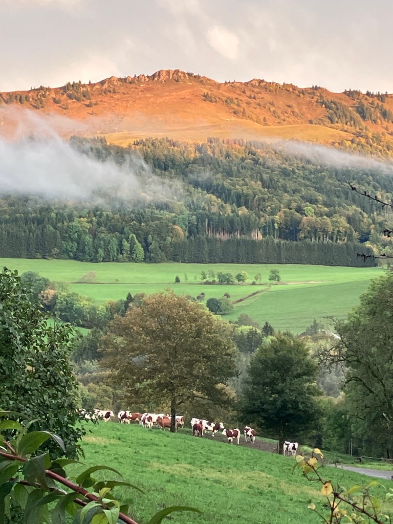
We watch the alpine glow and the cows waiting to go back to their barn.
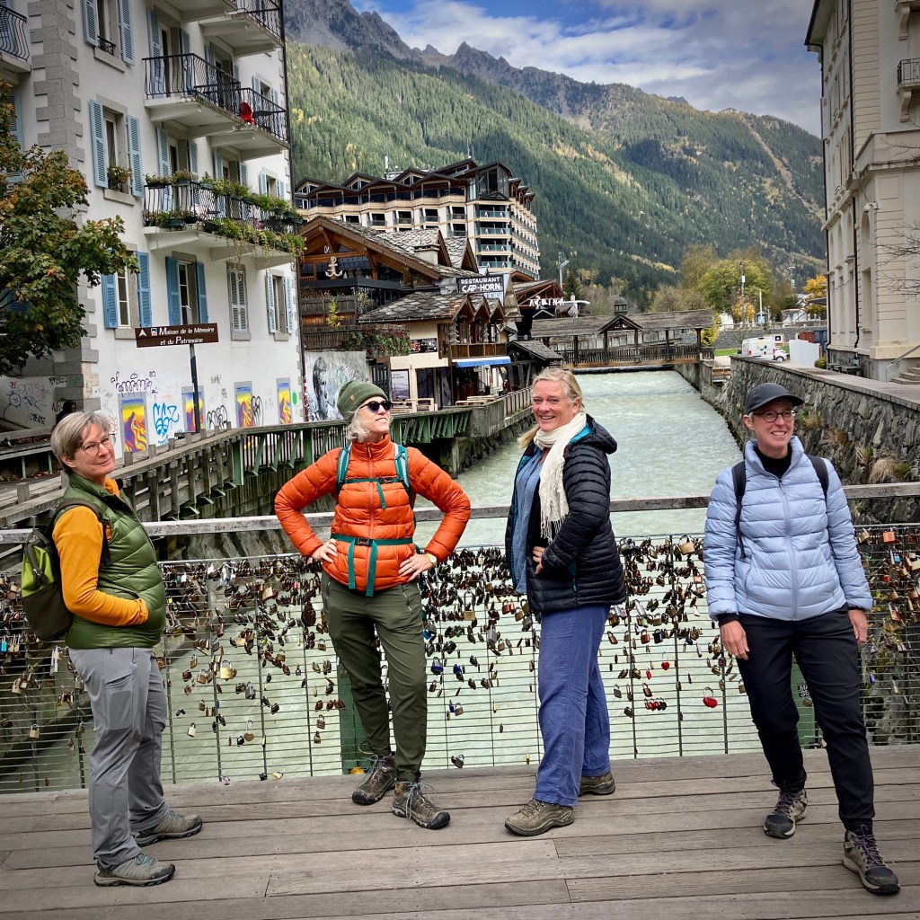
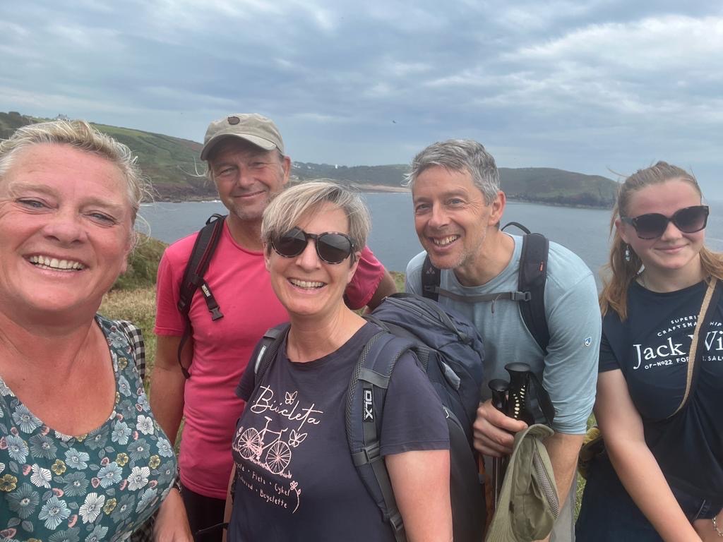
But this break was even better since we had our dear friends Christine and Cecily joining us for a week. Usually we spend our time in the alps hiking from the house, catching up on stuff, travel planning, cleaning and storing the bikes and trying to help around the house. Their visit gave us the kick in our pants to rent a car and actually get out and see some of the alps. We joke that for folks who have spent so much time in the area we hadn’t seen many of the local sights.
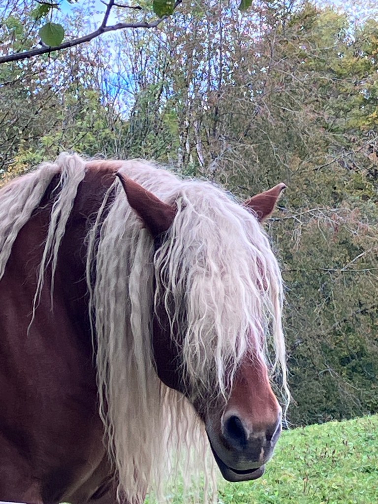
A rock star hairdo horse.
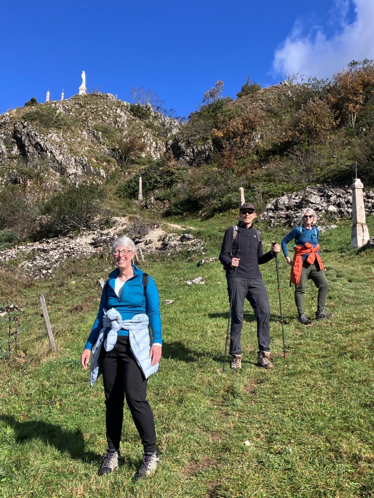
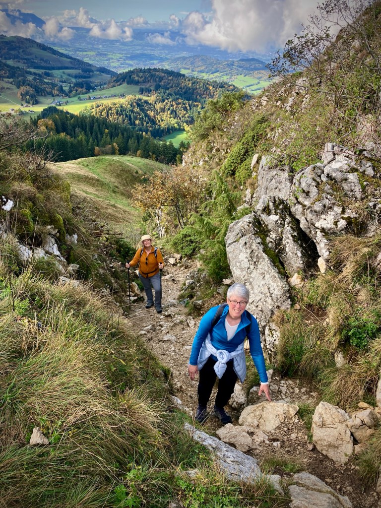
The best way we know to get over jet lag is physical activity in the sunshine. Thankfully the weather cooperated for our first hike, Plaine Joux up to Pointe de Miribel.
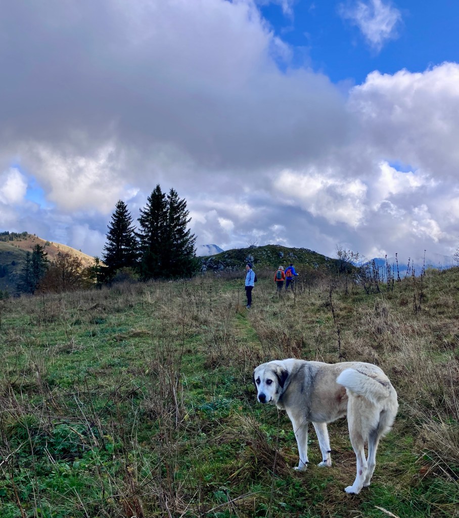
Blast the jet lag hike!Up we go.Remember to turn around to see the high alps playing peek a boo through the clouds.The last super steep bit. The summit! Photo credit to the nice Australian lady hiking with her dog.I can never get enough of the views – those huge clouds.And the wonderful friends.
The nice hiker with the dog warned us there was a herd of goats with their guard dog on our chosen route down. The dog barked at her and her dog, just so we knew. My sister in Colorado has had these big white guard dogs for her livestock for years so I assured everyone that they aren’t dangerous, just protective. Well, the big white dog did indeed bark at us, but calmed down after we greeted them with good doggie voices.
I’m just protecting my flock.And I will escort you out of my territory.If we had done our hike in reverse we would have seen this information sign before meeting the big dog.The fall colors were changing every day. For jet lag busting hike number two Rich and Cecily both had their fall appropriate colors on.Lac Léman under the fog.
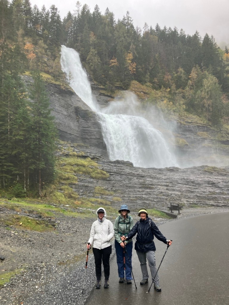
After a day just hiking from the house, we headed by car to Sixt-Fer-à-Cheval. The weather was rainy but we all just suited up in our rain gear and headed out on a fantastic waterfall loop.
Cheryl and Christine. Friends for 42 years.It was hard to know if it was rain or mist from the waterfall. Whatever- it was wet.A wet day meant we had the trails almost to ourselves.Cecily and Christine enjoying the break in the rain and the fall colors.The mix of trees makes for dramatic vistas. As did all the uphill hiking.Framed waterfall. It was all downhill after this point.
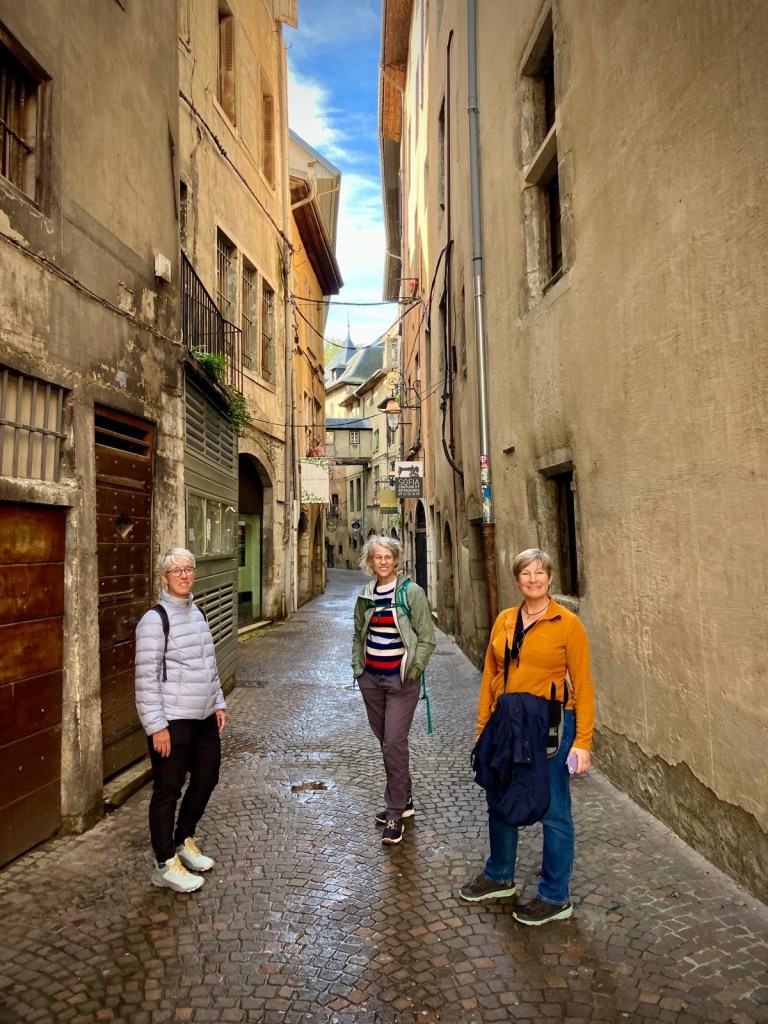
The next day our destination was Chambéry, which is south of Lac du Bourget. A nice walk around the old town, a visit to the Musée Savoisien and lunch.
Musée Savoisien had a great exhibit on houses of the Savoie region, and how and why they were constructed as they were.Really detailed architectural models of the different house types.The museum also celebrated one of the region’s most famous dishes. Tartiflette– potatoes, lardon, onions and reblochon cheese.
At a traditional Savoie restaurant for lunch, Christine had the tartiflette, which was delicious but rich. We all agreed it is not an everyday meal. But so luscious.
Rich captured what we called “our album cover shot”.
We learned a good lesson about renting cars, always add the second driver even though it costs more. Since Rich did all the driving he didn’t get to enjoy the scenery as much as the rest of us. We’re spoiled from California where the rule is that the spouse is always covered when it comes to rental cars. We should have added me as a driver so Rich could relax and enjoy the scenery too. So, with that in mind we took the train the next day. Rich still had to drive us to the train station but then we all got to admire the scenery from La Roche-sur-Foron to Annecy.
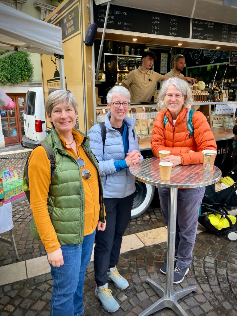
Train station usie.First stop in Annecy, where it was market day, a coffee cart.Fueled up to walk around town.One of Annecy’s beautiful rivers, Le Thiou. With fun and impressively sited fish graffiti.Cecily and Christine in the old town.Such a picturesque place. The water is crystal clear.Can’t stop taking photos!We weren’t the only tourists in town, but it wasn’t super busy. Just pleasantly hopping.The perfect case for retirement, lounging in chairs by the lake.
After a day at home, shopping and doing an airport run to pick up Hannah, we headed off the next day to Chamonix, a new place for the four Americans. The very impressive roadway leading to Chamonix and the Mont Blanc tunnel was mostly empty since the tunnel is closed for works until December 16, 2024. That made for a lovely traffic free drive along the impressive viaduct roads.
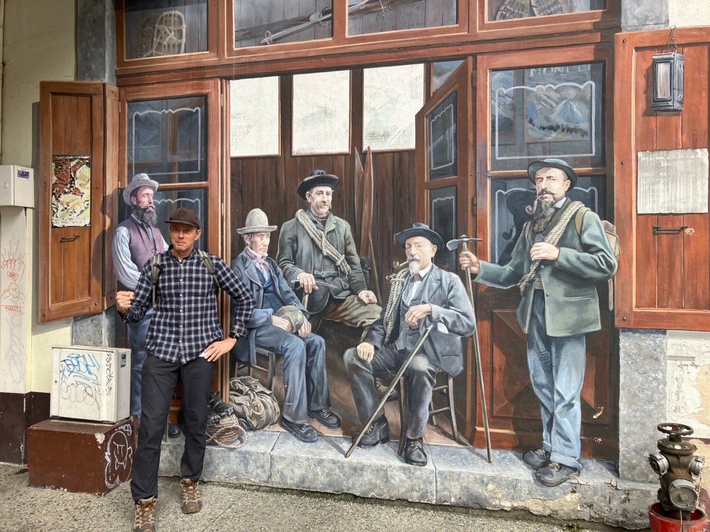
The top of Mont Blanc was shrouded in clouds, but we now had Hannah with us! Even with the peak covered the view is impressive.Another potential album cover.A glacial river and a glacier. Oh, and Cecily and Christine! Hannah and Cheryl, friends for 40 years. I do love being able to say that. Long term friends are so wonderful.Rich in front of a mural of famous mountain climbers.
Sadly we had to say to goodbye to Cecily and Christine as they were off by train to Italy for another friend’s 70th birthday party. We dropped them at Annemasse train station, they took the local Léman Express to Geneva, and then trains to Turin. Such a fantastic way to travel.
See you soon!
When we made our nomadic decision it was our hope that we would have friends meet up with us in various places. This visit by Cecily and Christine was so energizing and wonderful. To get to share one of our favorite places, the Vallée Verte, with two of our favorite people was fantastic. The biggest downside to our life as nomads is missing friends and family.
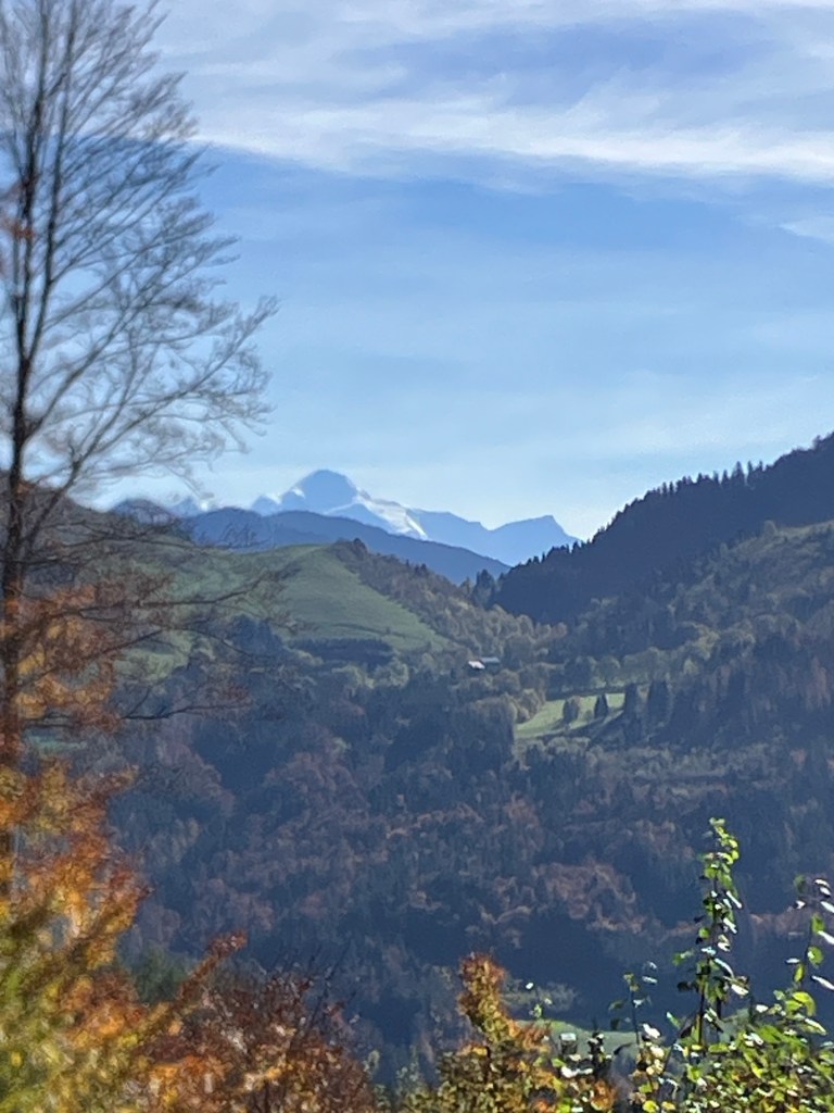
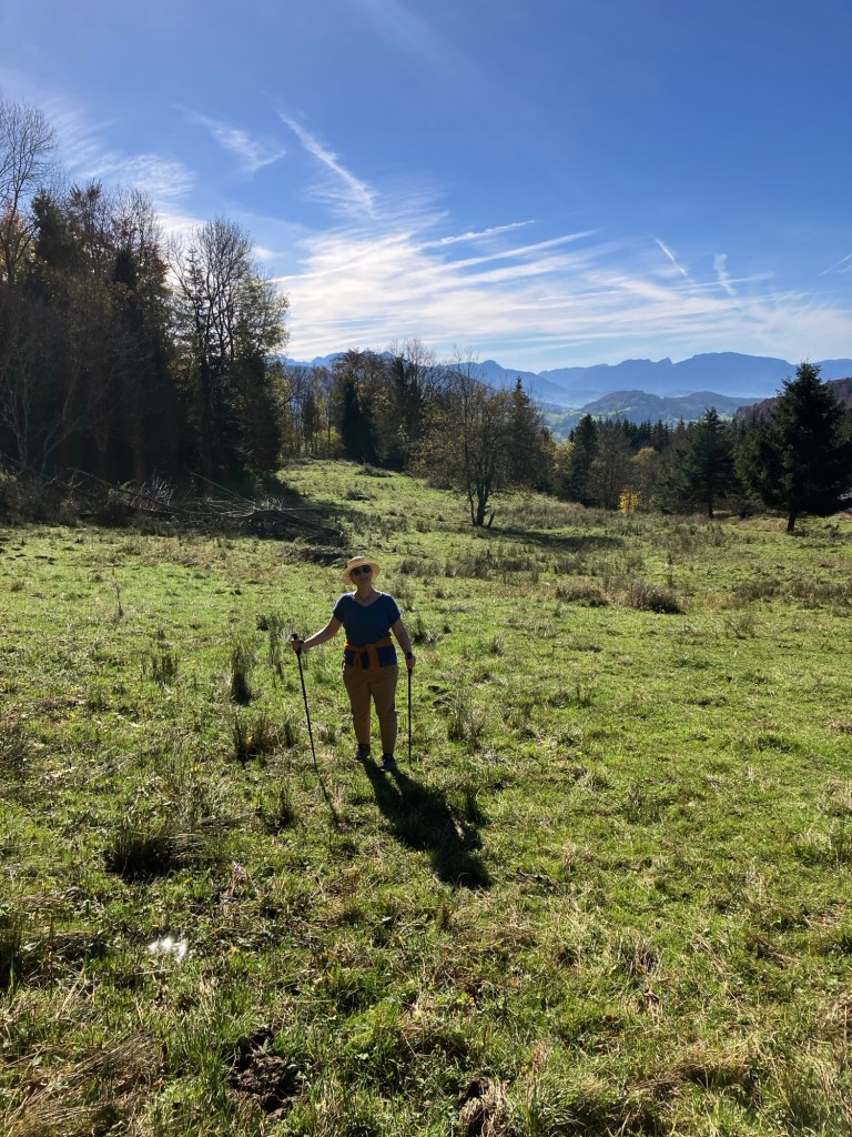
We also had bonus time with Hannah our wonderful host, and some lovely weather to enjoy.We got in some more good hiking.And got high enough to catch a glimpse of the reclusive top of Mont Blanc.Framed by fall color.That might look like a dry field, it was actually wet and swampy.The sign for the cooperative cheese monger in Boëge.Which has a fantastic cheese vending machine with curated selections, open 24/7. For those cheese emergencies.Calf in the mist.
Too soon it was time for Rich and I to shoulder our backpacks and head off ourselves. Hannah’s family had arrived so we left them in good spirts and got a lift to the train station in Annemasse.
After our challenging trains with bikes time the previous few weeks we were giddy to have only backpacks. This is so easy! We kept saying to each other.The travel planner enjoying his stress free train ride.
We were working our way to Paris for a month stay and more visits from friends, but first we had a few stays along the way. More on that in the next post.
The happy travelers in Chamonix. Life is even better when shared with friends.
Almost everywhere we go in the world, we hike. Urban hikes. High desert hike. Hot and sweaty jungle hikes. Gorgeous countryside hikes. Dodgy alongside busy road hikes. Amazing coastal hikes. British pub hikes.
Wait, what?
Rich is very good at finding hikes for us to do. And he’s a fast and strong hiker. The more uphill there is, the happier he is. I’m not fast and frequently get grumpy going uphill.
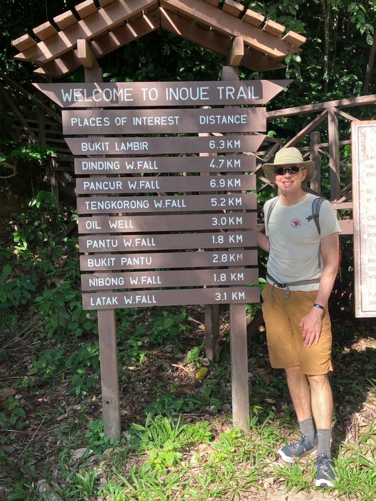
Lambir Hills, outside of Miri, Borneo.
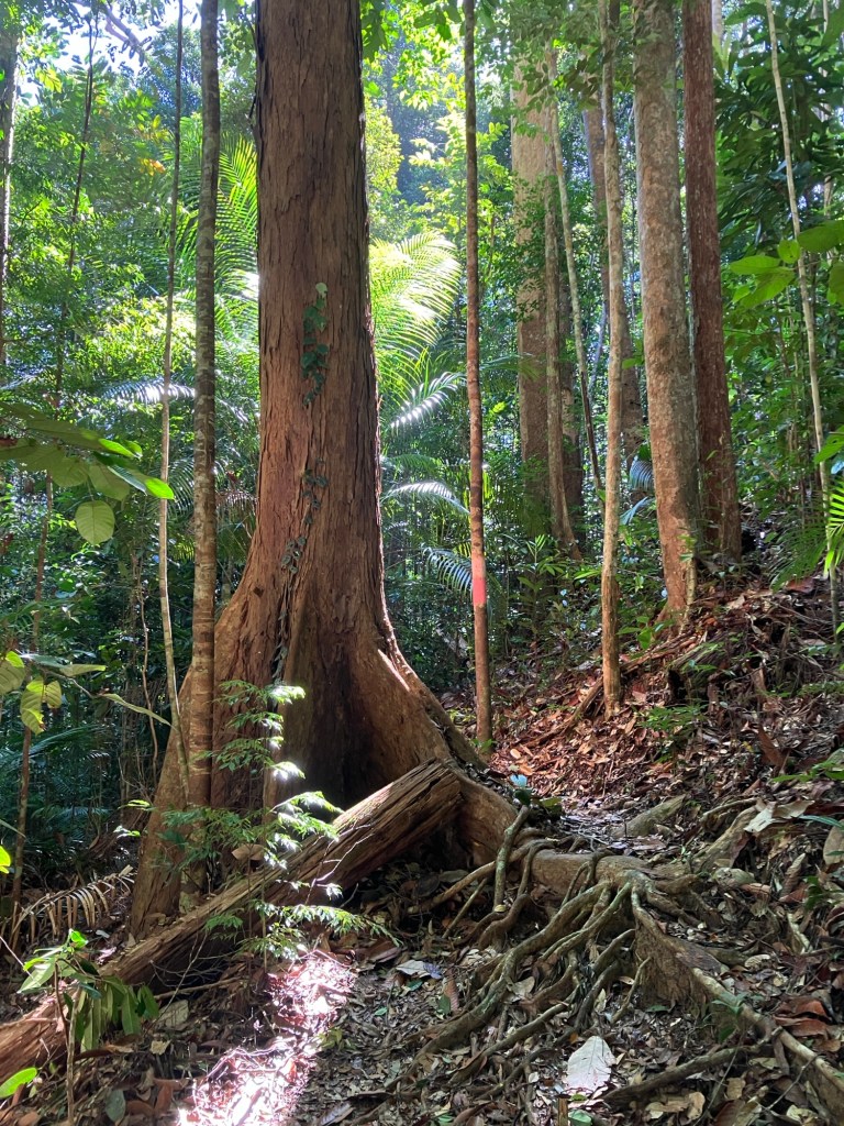
Hiking in the jungles and rain forests of Borneo is a challenge. Heat and humidity punish you, and the frequent heavy rains punish the trails, making them more like creek beds than trails.
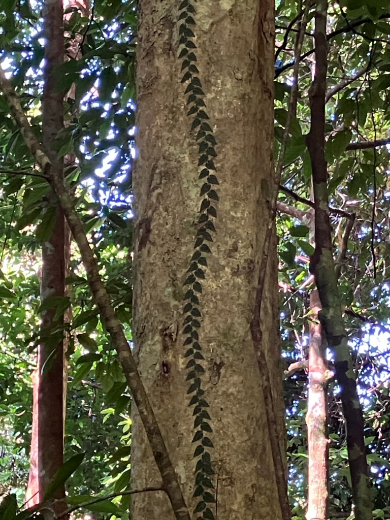
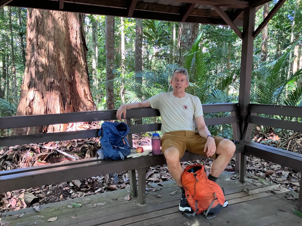
These could be easy day hike distances in a different climate and with different trail conditions.Hiking with a fan. Every little bit of breeze helps.Our Lambir Hills hike started off nicely. Uphill on a decent trail. Huge trees.Unknown to us vegetation. This climbing vine is so perfectly symmetrical. Looks like a tree zipper.A nice shaded rest stop.
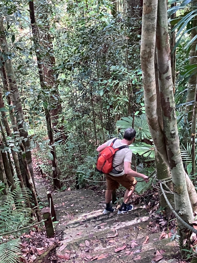
There seemed to be a period in Malaysian Borneo when trails were built and park buildings were constructed. Maybe 20 years ago, maybe 15? But maintenance is tough to keep ahead of. Or it’s not funded. It was sad to see the state of not just the trails, but some the other park infrastructure as well. After we crested the top of our climb the trail started to deteriorate. As it dipped up and down into drainage after drainage, ropes appeared to help you haul yourself up or steady yourself down the very rutted trail.
Up we go.And down we go.And up we go. Trail maintenance must be almost impossible on these trails.We saw one other group of hikers, they were better equipped, with trekking poles and matching hiking shirts. They were just getting to the tough part.My “we are not amused” look.
So what do I do when I’m not loving the hike I’m on? First, I remind myself why we hike. We hike because we like to see places only reachable on foot, and so we can keep on hiking. During a long bicycle tour two years ago we forgot to stop riding and take rest/hike days so we could work our hiking muscles. We found ourselves in fantastic biking shape and hurting on long walks and hikes.
That’s not Malaysia! With our dear friends Cecily and Christine in Seattle, December 2023.More dear friends in Wales, Hannah, Erik, and Thea. 2023.
Second on my list of hiking distractions is to remember hikes with people we love.
Christine, Annie, and Erika. Seattle December 2023.My brother Steve and sister-in-law Claire, Pismo Beach California, 2017.My brother Steve and my sister Kathy, Colorado 2020.Rich, Mike, and Milo. California, 2021.Mike and Kathy, California 2022.
We’ve had some of our best discussions, and come to some of our most life directing decisions while hiking. What have we decided while hiking? Whether or not to have children. Should we sell our place and travel. Do we need to actually own a car. Answers, no, yes, and no.
Above Tetouan, Morocco, 2021.UK, the Lake District, January 2022.On the Camino del Norte with Cecily and Christine, Spain, October 2022.Snowshoeing with Cecily and Christine, Snoqualmie WA, 2023. Oh, that cold weather. Hard to remember what cold is like when you’re in Borneo.
Every hike has its tough elements. The moments when you wonder why you hike. But then nature reveals itself and you remember again why you hike.
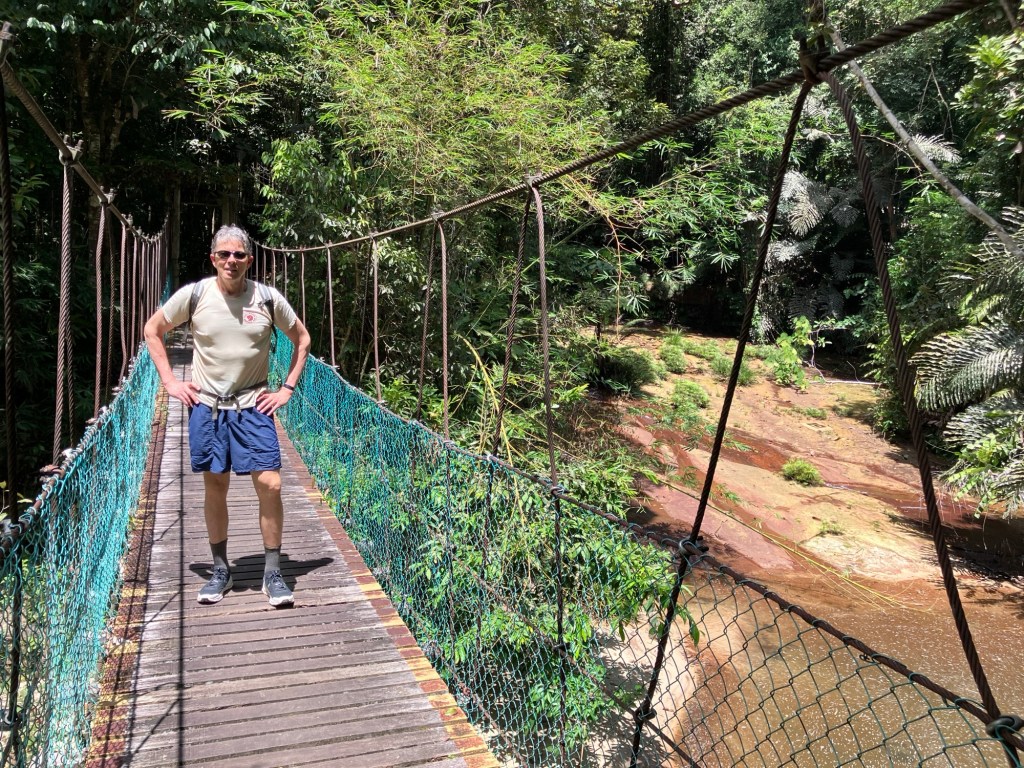
Huge tree reaching for the light.These trees did not let you forget you were in a rainforest.The canopy is far overhead. No surprise there is a lot of water.Including a waterfall at mile 5. From the waterfall it was only a kilometer back to the park office where our Grab car would pick us up.A very refreshing swim.
The rainforest is stunning, but I was happy the hike was over and our air conditioned hotel beckoned.
Oh you thought this jungle was done with you?Thankfully Rich did a quick step back and did not tread on this snake. Not a pit viper but we still gave him respectful space.From the park office to the waterfall is a popular trail, and in better shape than the rest of the park.A view of Miri from our hotel room.The hot, sweaty, pink, but happy travelers.
We’re in Kuching now, the city of cats, and heading out for a jungle lodge experience at Batang Ai, at the Nanga Sumpa Lodge, early tomorrow.
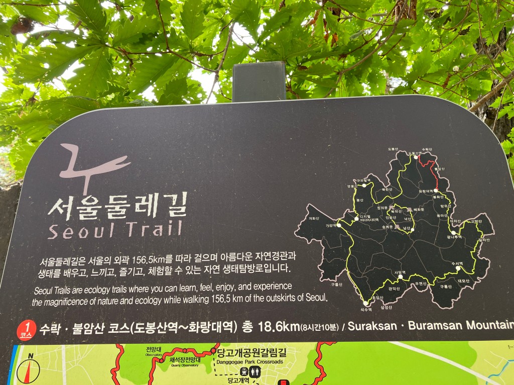
We knew that Koreans love to hike. Even if we hadn’t known that before coming to Seoul the sheer quantity of hikers using the metro would have tipped us off. Boots, backpacks, hiking poles, sun hats, we felt right at home with these transit enabled hikers. We hadn’t planned on turning our time in Seoul into a multi day hiking expedition, but that’s the joy of travel. Sometimes you just never know what’s going to happen and what you’ll find in a new place.
A view from our second or third mountain hike. A view from the Seoul Trail.
You may be realizing that what these views have in common is that we are looking down at the city. Down as in ‘we climbed a lot of darn steps to get up here’.
Looking at one mountain park we climbed, the little one to the right, while climbing another mountain park. Playing the game called find our high rise. The air was quite clear on our first hiking day. Rain was coming in a few days so we hiked three days in a row.
Rich found the first hike for us by seeing the mountain park from our 12th floor window and navigating us there hoping there would be a trail. There was. And there was an amazing accessible boardwalk style trail all the way up to a temple and a cafe. Maps.me was helpful, showing some trails, and Alltrails had some as well, but lacking a great mapping site we relied on Rich’s wonderful navigation skills.
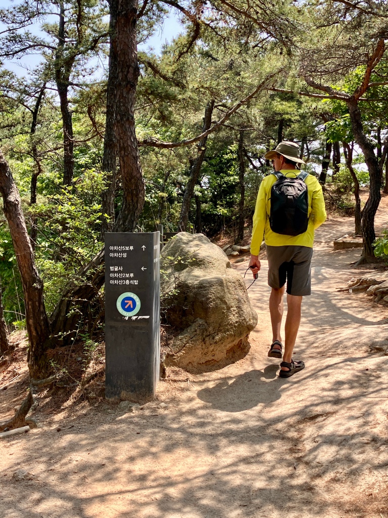
Once we were on the trails the signage was quite good.Very comprehensive signage on the Seoul trail.
Since hikers are getting to and from their hikes on the metro, there are also signs to get you to the trails from the neighborhoods.
Turn here to get to the Seoul trail.A comprehensive hiker sign. I like they have a backpack and a pole. And a big version in case you fail to see the smaller sign. Seoul wraps around and up to some impressive mountains, when you get off the metro you see this. Head that way.
The signage and maps varied in detail, and confusingly played fast and loose with having north be at the top, but on the whole you were well taken care of, signage wise.
A big view of mountains and the trail networks. Including metro stations. A map showing the 156 kilometers of the Seoul trail.
Not only was the number of trail opportunities great, the amenities along the trails, and the construction of the trails were impressive. Very nicely maintained steps, benches and picnic spots, restrooms, and my new favorite thing – carpeted trails. It looks like jute, or coir, and for stretches that are steep up or down, or could get quite muddy, it’s super helpful. It also stops the usual trail ruts from forming, or the footsteps turning into hardened mud. And dang, carpeted trails – what’s not to love about that?
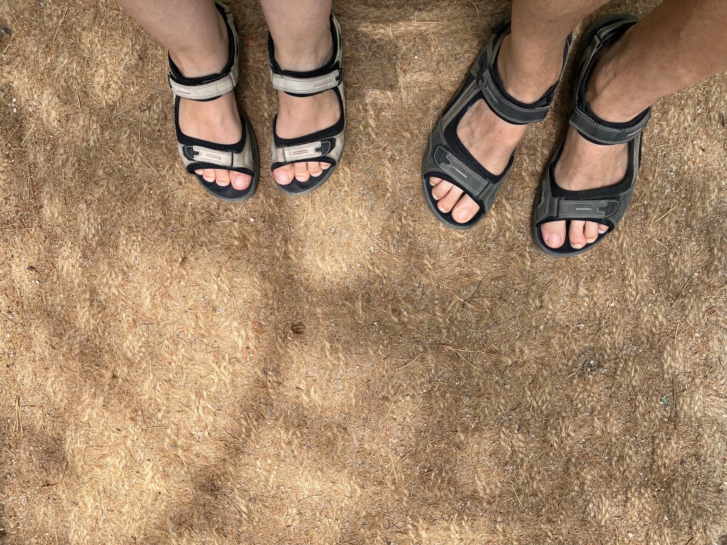
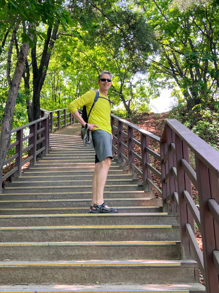
This one was new. You can appreciate the weave. A more worn in stretch of trail carpet. And our much worn Ecco sandals. Restrooms, clean and with potable water unless otherwise noted.A pine grove with plenty of picnic benches. Seating and shade. An accessible trail gently climbs towards the view spot.Where there were stairs they were also well built and maintained. And usually wide enough to handle the crowds of enthusiastic hikers. This was a weekday so there was not as many people as we imagine show up on weekends.Rich heading up.And up. And then down. This hike day, a section of the Seoul Trail, had about 2,000 steps.
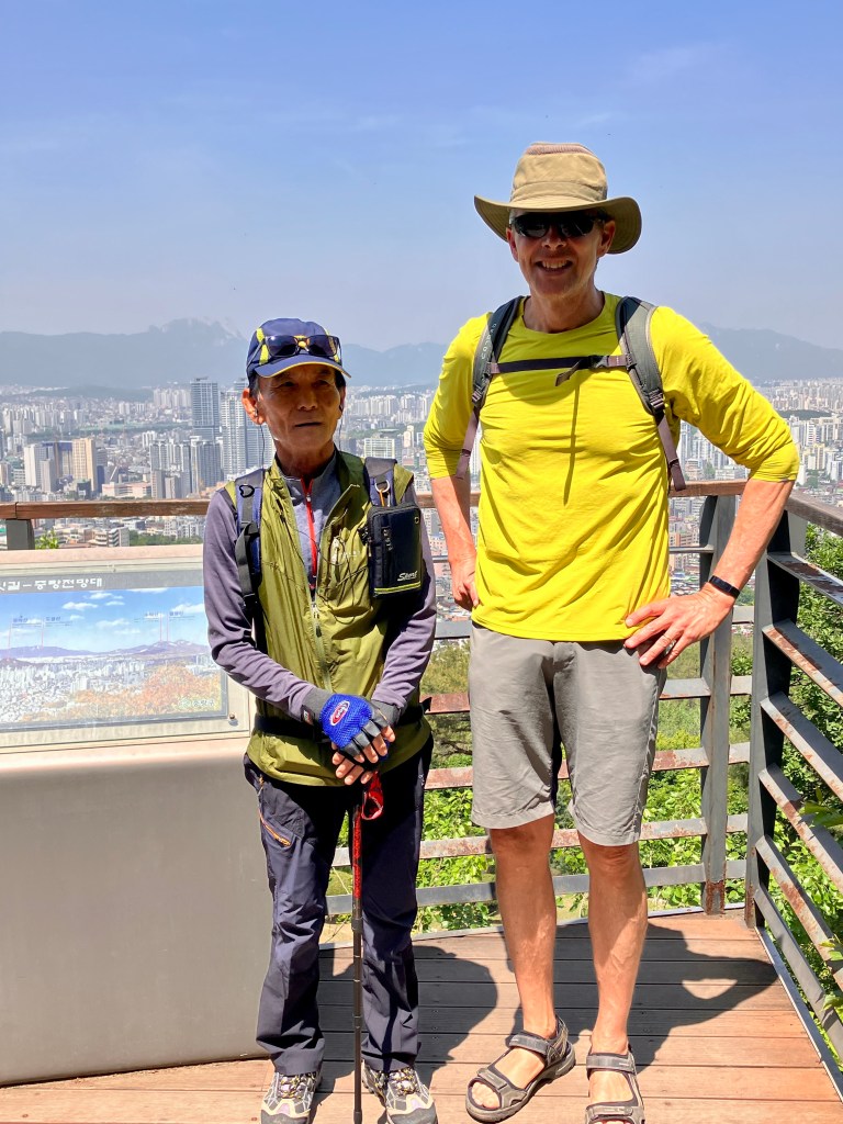
It’s not unusual for us to come to a city and skip the A list sights. Doing things we love to do, like hiking or biking, or even just walking city streets, gives us more insight into what life is really like in a place like Seoul. Seeing the neighborhoods far from the tourist friendly zones. Going into restaurants with basically zero idea what kind of food they serve. And hiking trails like these, full of locals. I tell Rich he’s never happier then when there are zero other western tourists. I developed a rating scale for him of tourist bombs – a high of five is a lot of tourists and not going to result in a happy Rich, and a low of one is good, but zero is better. After the tourist bomb rating is the wide eyed locals rating – which shows how surprised the locals seem to be to spot two big foreigners on their trail or in their small neighborhood restaurant. Our best hike was zero tourist bombs, and five wide eyed locals, the highest rating possible in my new rating scale.
A friendly fellow hiker. Even with few common words he and Rich got along over pointing out buildings. This is a typical hiking outfit for the locals. Rich’s is not! Our sandals were definitely unusual.
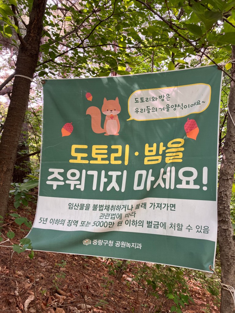
In addition to good trail signs, there are informational signs about archaeological sites, and signs asking folks to please not collect acorns and chestnuts as the wildlife depend on them.
Good informational signs with english translation.This cute squirrel would like you to leave their food alone.Another reminder to leave nuts on the ground for forage.
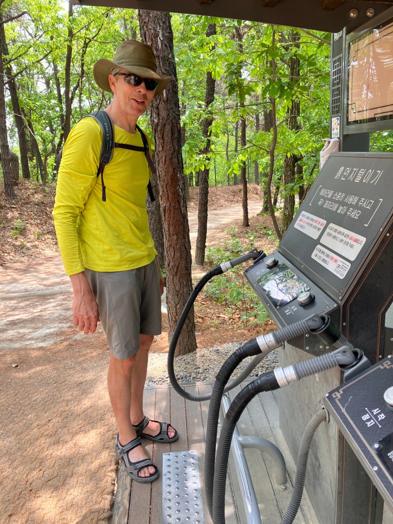
You might be thinking, ok, so that’s all impressive and interesting, but lots of places have trails, and signs, and views. Well hold on to your sun hats, there’s more.
Stamps! Like the stamps we didn’t collect along the Seoul to Busan bike route, and in Japanese train stations, there are also stamps we didn’t collect along the Seoul Trail. So cute. Each station has a unique stamp.These. What are they, you ask?Compressed air blowers. To remove the dust from your shoes and trousers before you head back into civilization. The sight of these meant you were nearing the end of your hike. Or a connection out to a neighborhood or metro station.Felt nice to dust off our sandals and legs.Rock stacking. In California this is discouraged behavior, but here it has Buddhist origins, although some folks apparently just like the challenge, adding a rock as they walk by.Ribbon blaze markings, so you can keep to the Seoul Trail at crossroads. A group of adorable young hikers, an entire class went by us, greeting us in Korean. We were charmed.
The unexpected pleasure of hiking in Seoul was highlighted by all the amazing views. As you climbed up, wrapped around, or climbed down a mountain park, you got new views of a different part of this mega city.
A view across graves to a cityscape and another mountain.This high stretch reminded us of Desolation Wilderness near Lake Tahoe.But we never had views like this in Desolation.Scrambling down towards the city and a metro station.Getting closer to civilization and lunch, passing by a community garden site.The reward? Tofu Bibimbap. It was delicious and I let it sizzle in its dolsot (Korean stone bowl) so the rice got nicely crisped on the bottom.
I want to include some tips for hiking in Seoul: Keep your metro card charged up, all the hikes we did are transit friendly. Bring snacks or lunch, the smaller neighborhood parks might have a cafe, but the longer trails that we hiked didn’t. Bring water, we were able to refill on all of our hikes eventually, but bring enough water to last for most of your hike just in case. Now, how to find hikes. You can assume that every mountain you see has trails, but finding a trailhead might be a little tricky. Rich used a combination of google maps, maps.me and All Trails. You can find information about the Seoul Trail at English.Seoul.go.kr and on our links page. If you find yourself confused, ask a local or follow someone in hiking gear.
The happy hikers on one of our Seoul hikes.
We’re at Incheon Airport now, slightly dreading the 12 hour fight to the US. I will definitely do a post about the food we ate while in Korea. The good, the not my favorite, and the mysterious that Google translate failed to help us understand. See you soon San Francisco.