A Rift in Our Travels

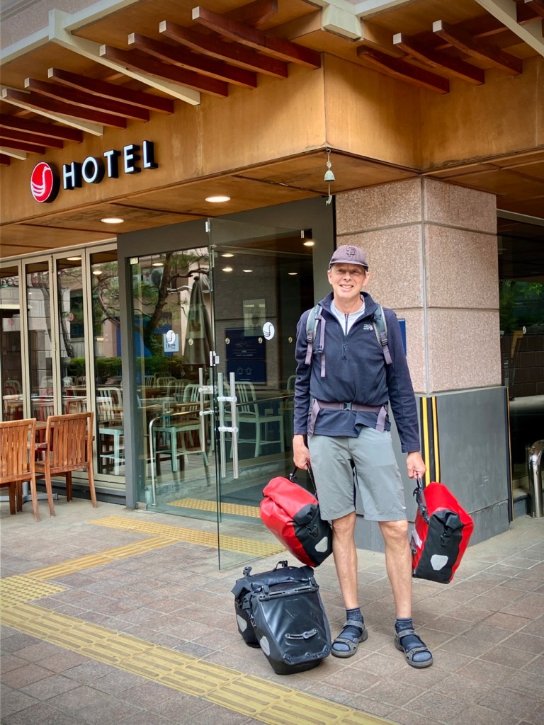
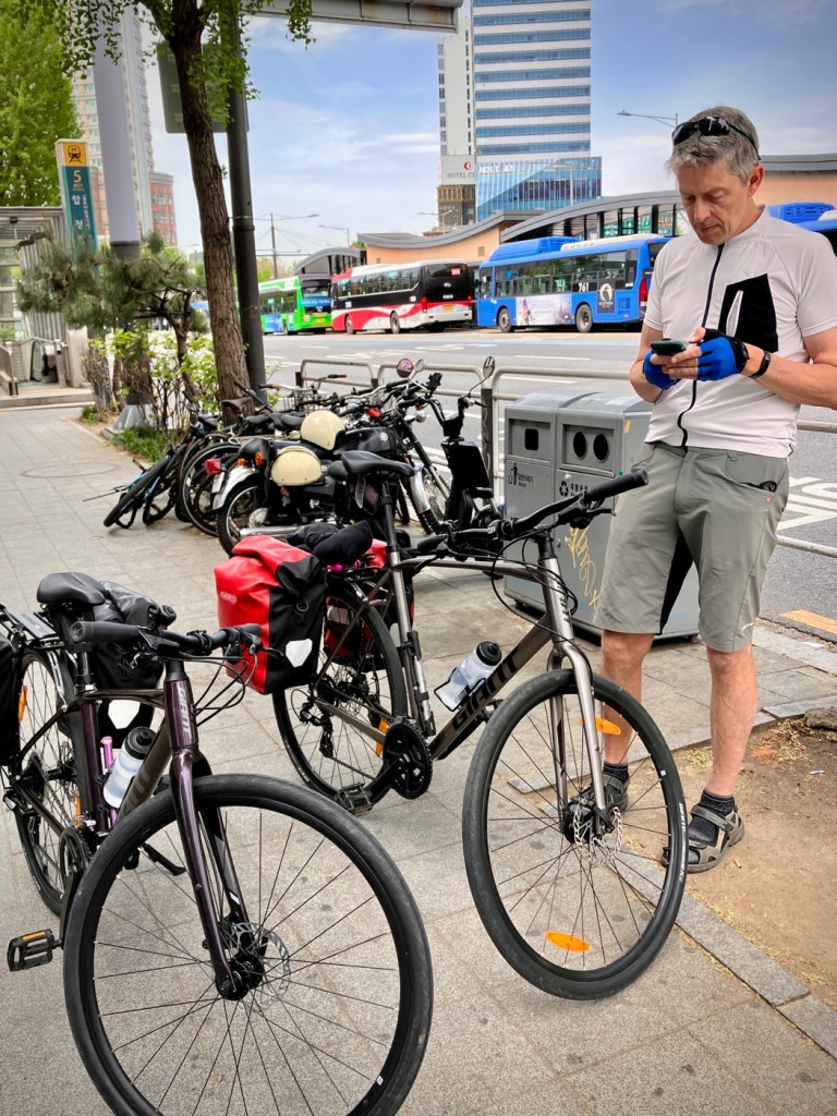
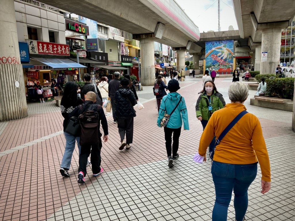
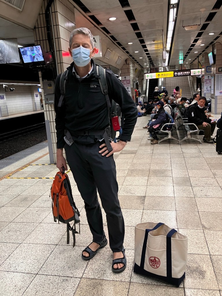
After three days of romping around Taipei and getting over our jet lag, we set off from the city on a big clockwise loop of Taiwan.

Rail is in my heart at the Hualien Railway Culture Park

We were excited to head out of Taipei Central to Hualien City, at the north end of the East Rift Valley. Hualien is a city reinventing itself with culture and art, and is now more than a gateway to the immensely popular Taroko Gorge.

A bit too early on the platform at Taipei Central; Cheryl’s trendy TJs bag at my side
Ocean view from the TzeChiang Express train. Plenty of room in the standard seats

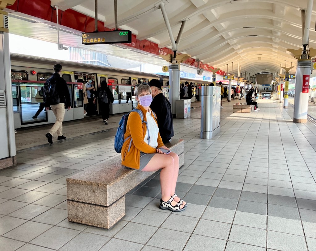
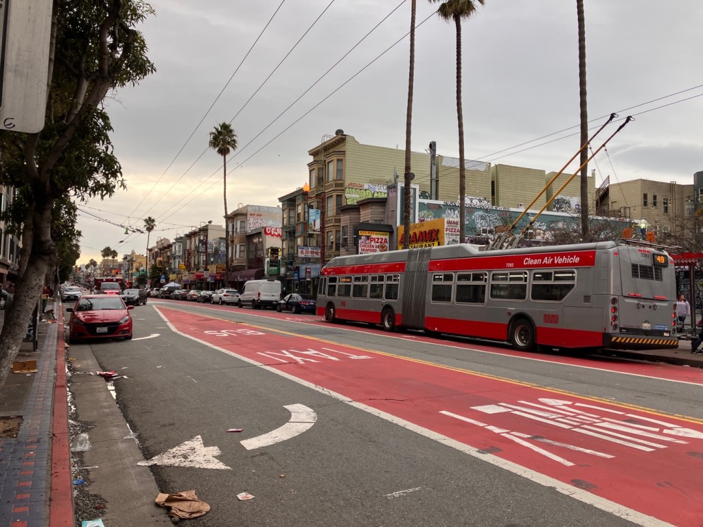
But first, a few train tips for the wonky planners out there. In addition to local and high speed rail on the west coast, the east is served by modern Tze Chiang limited express trains travelling up to 125mph. They are spotless, spacious, and punctual. And although we tried the business class on one segment, regular cars and seats are plenty roomy. If anything, we found the new trains a bit too clean and sterile, but certainly a pleasant and very low stress way to go.

You can pre-order a train bento on the TRA App for less than $3 and it’s delivered to your seat

Taipei Central’s local platforms are not wide or particularly pleasant and there are not really any services beyond the pay gates, so I’d recommend getting to the platform no more than 10 minutes prior to departure as it’s easy to find the platforms and coach number sign. Hang out or get food in the adjacent shopping mezzanine. At some stations; they don’t let you onto the platforms until 10 minutes prior.

The regular meat bento was pretty good considering, although maybe not up to the hype of its somewhat cult following. Cheryl got the veggie version -:).
Happy arrival at Hualien Station.

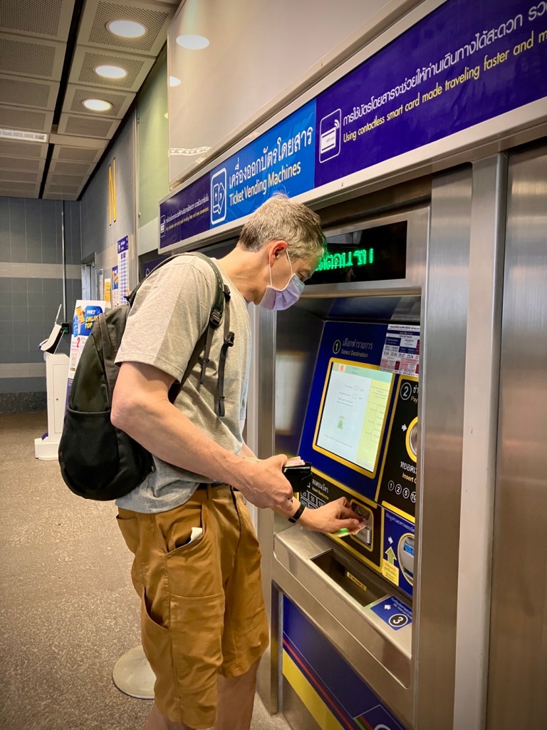
You can buy tickets on the TRA App or at the stations, but I found the app pretty convenient for booking tickets once you get the hang of it. One person can buy tickets using their passport number for up to 5 people and pay by Credit card or Apple Pay. You then collect your ticket on your mobile and have the other passenger (s) download their ticket on their phone (in the App) as you provide the reservation # and a 3 digit collection code.

Back at the railway park
The charms of many smaller Taiwanese cities take awhile to reveal themselves in back alleys, converted old buildings and lots of plants.
Red lanterns ready to be deployed in Hualien for the month+ long Lunar New Year celebrations.

Note that as soon as you click on a specific train after searching time and destination, a reservation and seats will be made immediately. You have a reservation and specific deadline shown to pay via credit card or Apple Pay (very convenient) or at the station. You can delay paying for tickets for a day or two (it gives you the deadline). This gives you an easy option to change or cancel tickets, but a word of warning, I did this a few too many times as I was learning the system and it locked my passport number for a month! I’m guessing the limit was about 4-5 incomplete/unpaid reservations. I could have called customer service and perhaps begged for tourist mercy, but we got around this by reversing our process and buying the tickets on Cheryl’s TRA app (and her passport number) and then I downloaded second ticket to my phone. You only need one ID to buy tickets via the App.

The hipster guide to Hualien

It also is smart to wait to collect the tickets on the App (or at the station) until you are sure that you want to take that specific train, as this allows you to change a ticket on the App, not just at the station. Apparently locals don’t “collect” tickets until the last minute for this reason.

Funky and green charm in Hualien.
Hip coffee shops abound and are generally only open after 11am or even later as the coffee cafe culture is an afternoon thing in Taiwan.

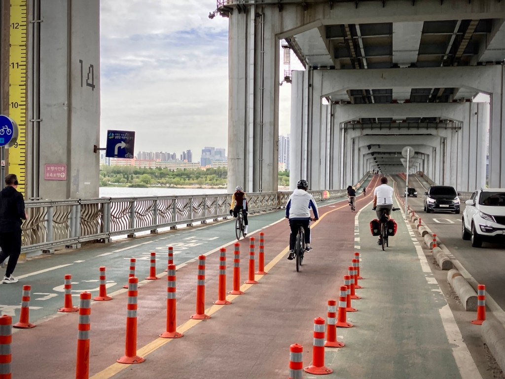
By the way, there are also local trains that you can see on the App timetables but you can’t buy reserved tickets. For those, you just show up and use your IC tap card to enter and exit the station and take any seat on those trains. They are also the easiest option with bikes.

Ready to scan my QR ticket at the turnstiles.
Taiwan is really promoting cycle tourism and these helpful signs are everywhere around cities, transfer areas, and stations.

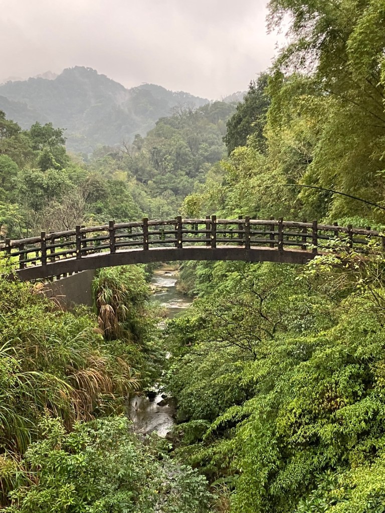
Besides trains, I love to study the geography and geology of the very place we visit. It always shapes the history; culture, and economy. The geography of Taiwan is dominated by a central ridge of mountains, the remnants of the formation of the island from magma rising up between the junction of the Eurasian’s and Philippine tectonic plates. The central range reaches heights of over 3000m (10,000ft) and it does snow sometimes in the higher elevations in winter. So only 30% of the country is flat, and much of that is highly developed.

The coast north of Hualien.

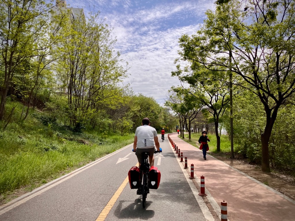
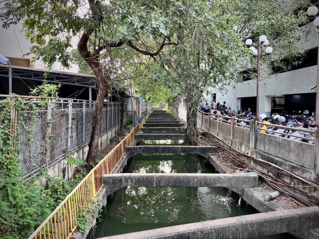
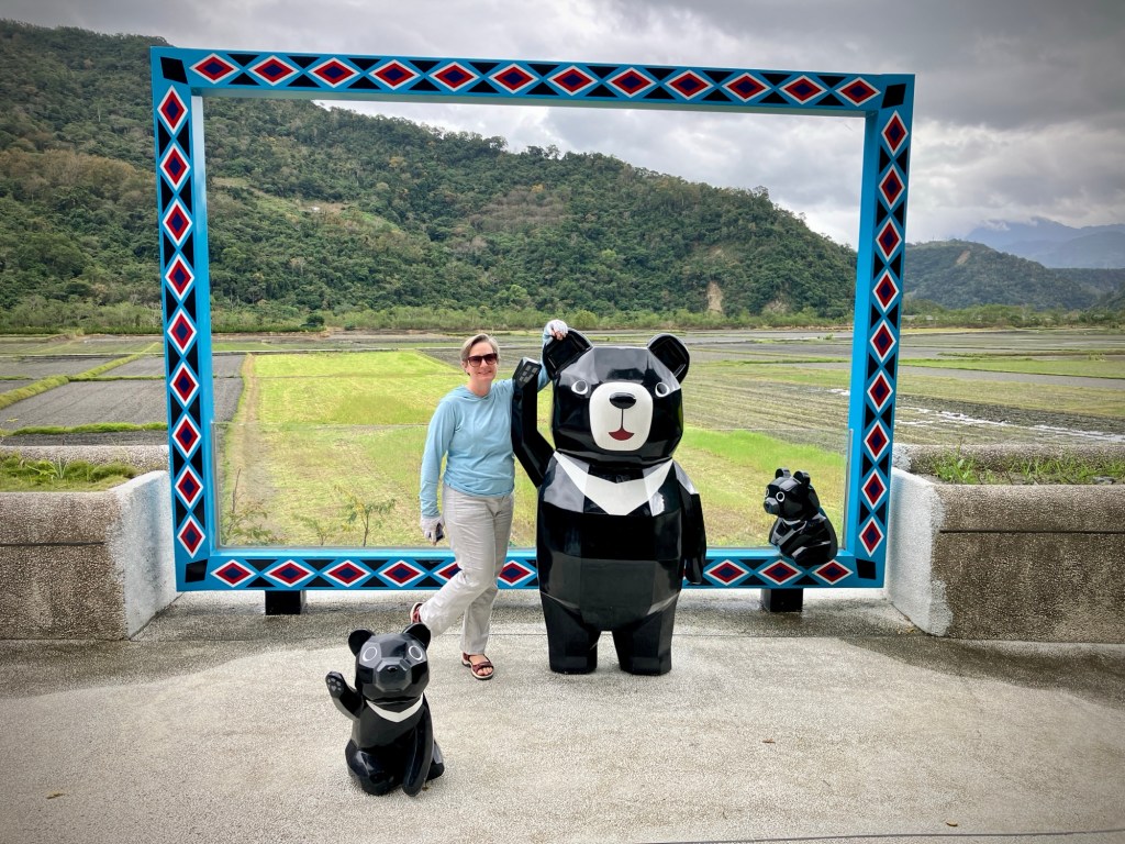
A second smaller coastal mountain range hugs the east coast. These ranges are both actually rising as the Philippine plate continues to push against and under the Eurasian plate. The valley where the plates meet, the East Rift, is one of the only flat areas on the east side of the country. It’s also fertile for growing things year round and attractive for cycling. Most of the industry and population of Taiwan is concentrated on the north (Taipei valley) and west sides, so the east has always been considered a more wild and remote place.

We loaded up on veggies at the Azure Hotel’s amazing vegetarian breakfast buffet for three days and used it as an excuse for street food, night markets and other less healthy options the rest of the day -:).

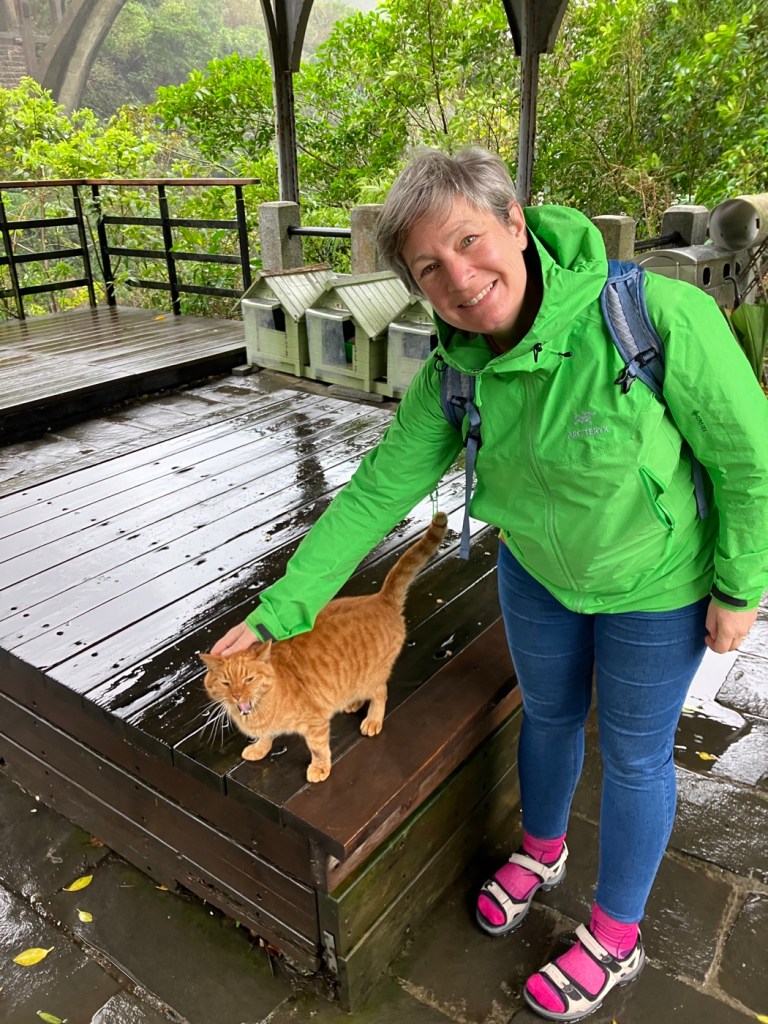
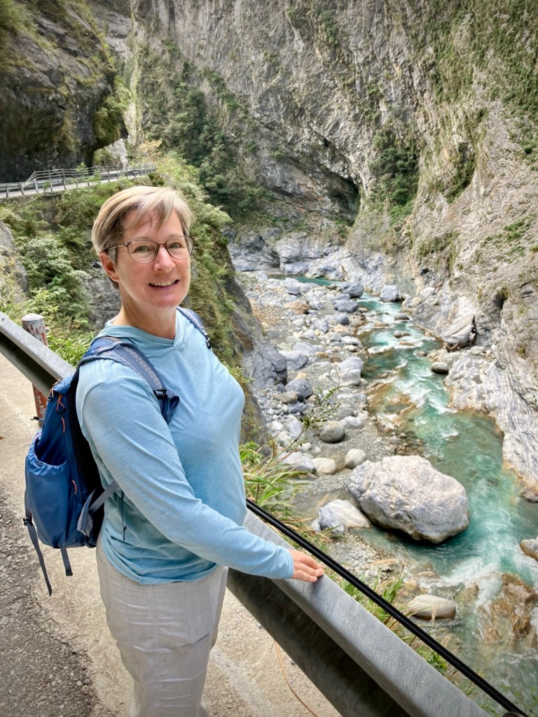
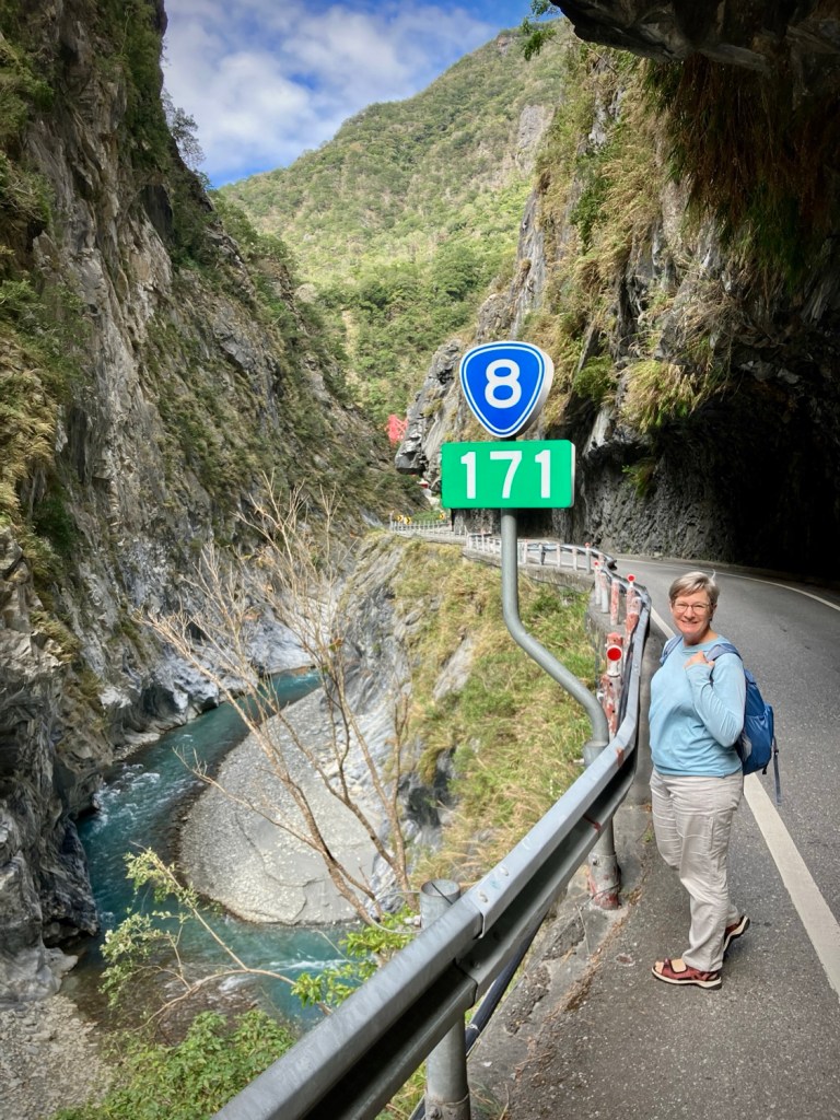
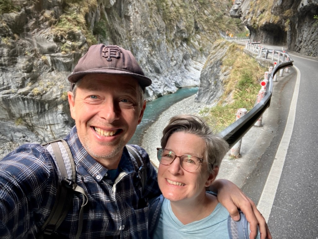
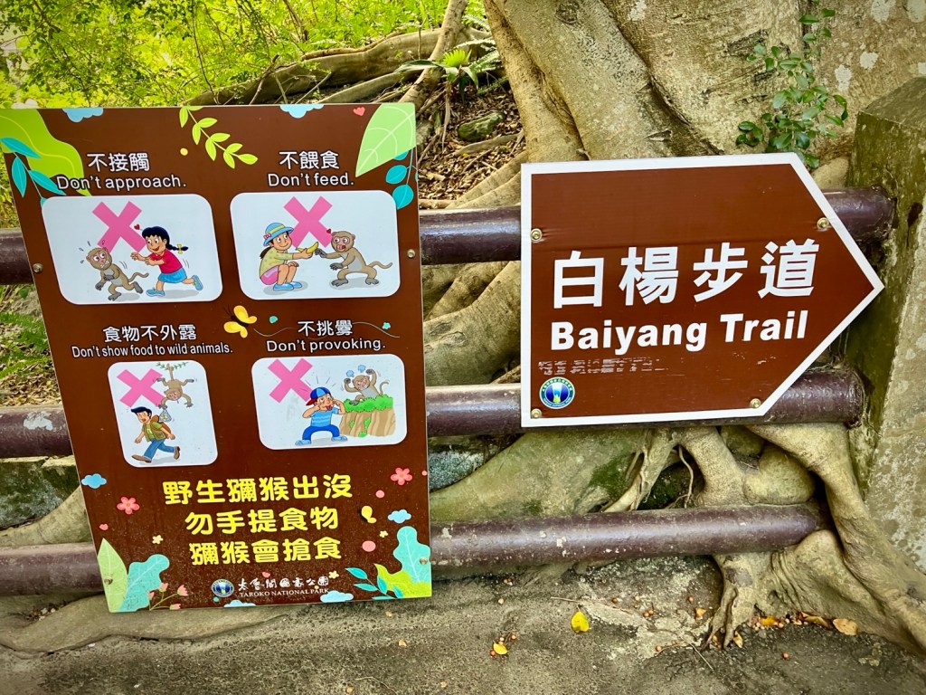
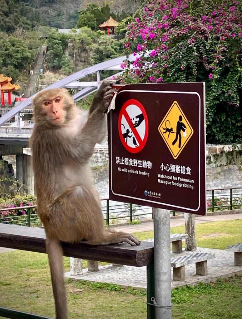
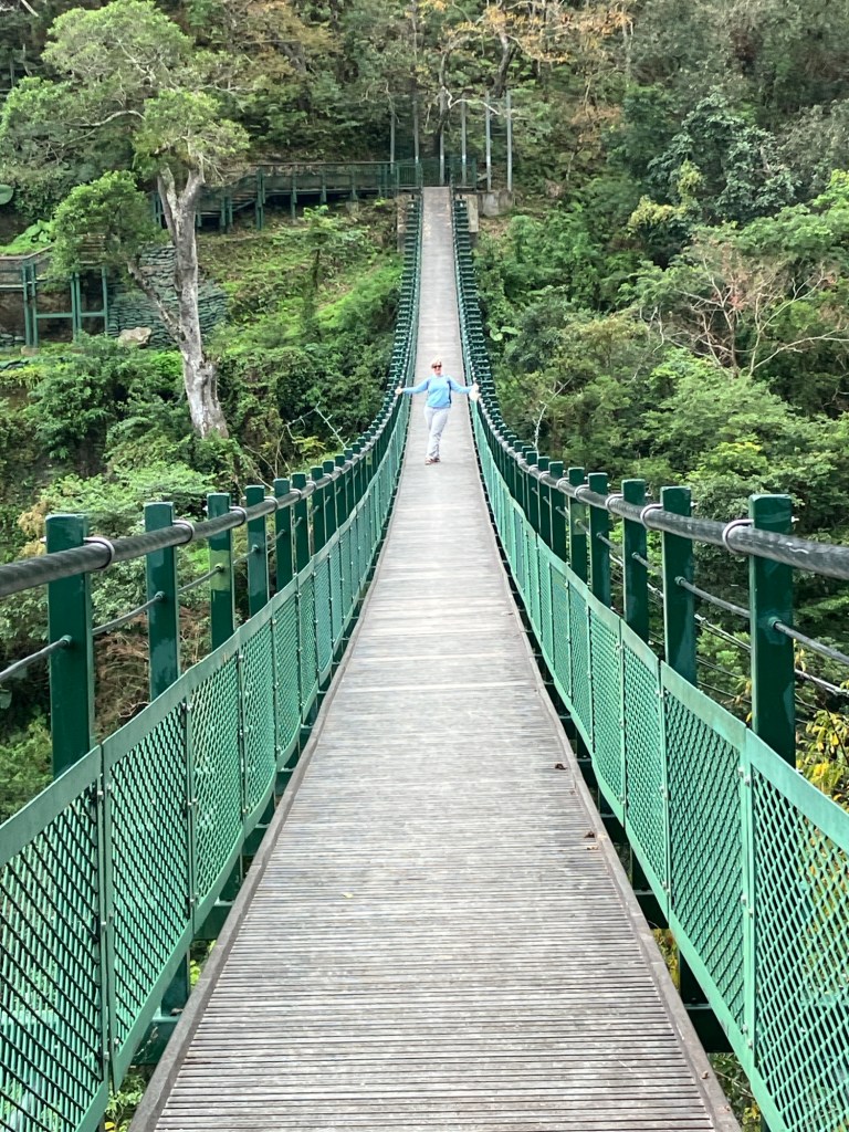
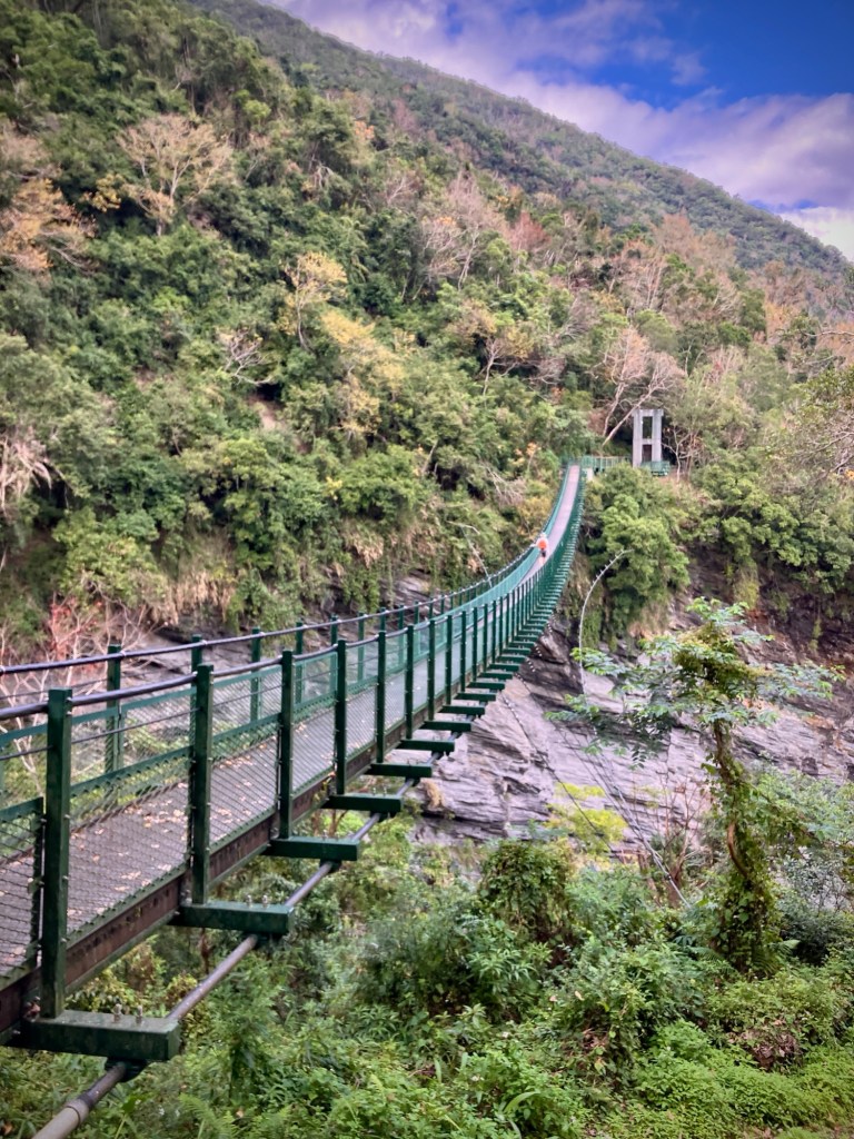
Ok, so onto our travels. We spent three days in Hualien and used it as a base to visit the famous Taroroko gorge and Taroko National Park for a full day by train, bus, and foot. The geography of the mountains is dramatic and consequently there are a lot of issues with rockfall, slides and road/trail closures. There are very limited bus services up and down the gorge now due to construction around a massive landslide that occurred in October 2023. There is single lane traffic controls and you can wait for up to an hour to get through each way, even if you hire a scooter or taxi for the day.

Ready to go to Taroko Gorge!

But we love buses and challenges, so decided that we would catch the earliest #302 bus from Xincheng Taroko station at 9am (the #310 bus is not currently running into the gorge) and ride it all the way to its end at Tianxiang. You can drive (or bike!) further than that and apparently it is much less visited beyond the reach of the buses.

Oops, our electric bus broke down half way to our destination in the park.

Our short train hop from Hualien arrived Xianming about 8:30 and there were about 30 tourists waiting for the bus, including some other Americans from Utah. After we boarded, the driver made a long speech in Mandarin that didn’t sound encouraging but somewhat surprisingly, our young pale Utah friend spoke Mandarin and translated for us. It turns out he was half Taiwanese! The driver was just preparing everyone for what we already knew, that there would be significant delays at the construction. So the half of us who were still on the bus at the construction were all patient for the 40 minute delay.

So we started walking
And enjoying the views
Light traffic due to the road closures

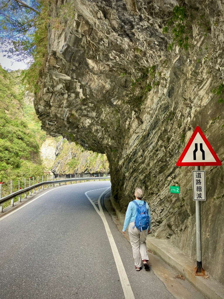
We were finally rolling again through the closure and spectacular gorge scenery, when suddenly the electric bus started to stall and sputter. The driver mumbled, stopped, and fixed (rebooted?) the batteries in the back, and we rolled on again slowly. But alas 500m onwards the bus finally died for good. So the remaining dozen or so of us got off and walked on the road. But we soon figured how nice it actually was walking the road, as the normal continuous two way traffic didn’t exist due to the long road closures all day. Roll with it and we’ll see what we see.

Happy travelers rolling with the bends in the road today
Plan B, walk the Lushui trail for a few kms
Oops; trail closed midway so back to the road
Cheryl resigned to wait for the next bus…at least she had some books on her phone…

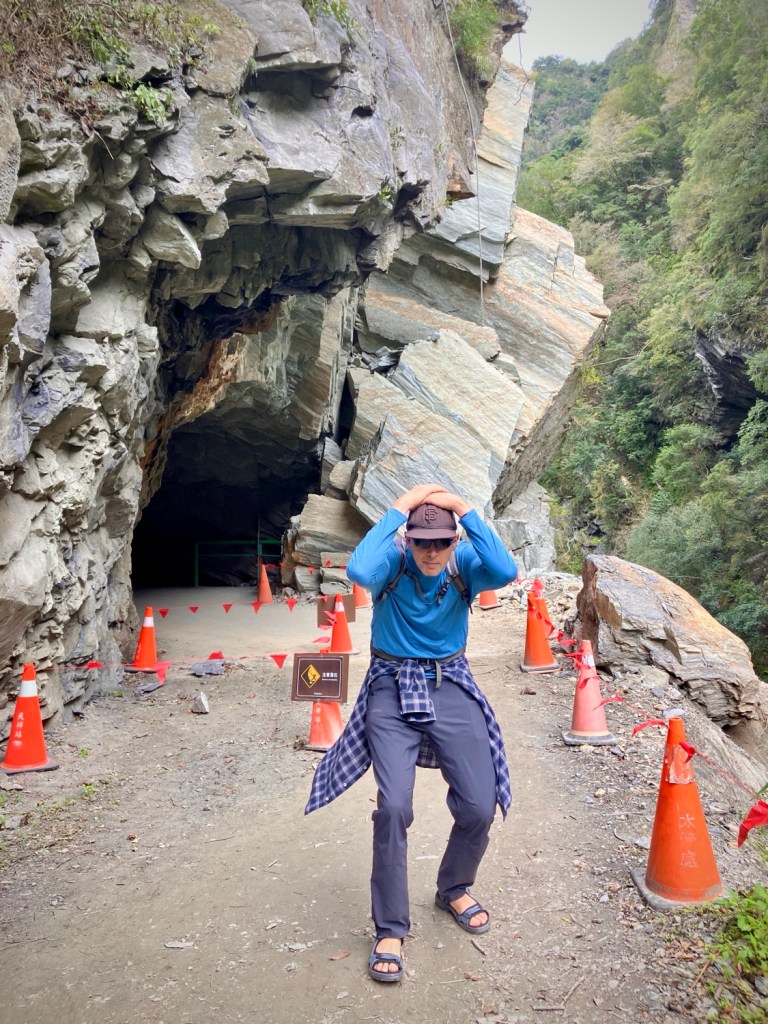
It was peaceful and beautiful, and we walked to a campground area with bathrooms a few kilometers up the road. We then decided that we’d hike some of the Lushui trail which branched off the road above and then try to catch the next bus as it rolled by in about an hour. Well, the geologic gods had also closed that trail in its middle, so after a pleasant 30 minute out and back, we returned to the campground bus stop and resigned ourselves to wait up to an hour for the next bus. It was too far to walk (15km) and there were dark tunnels with no shoulders. But after about 10 minutes, a nice young Dutch couple in a little white car came by and offered us a ride to the end! Very nice and put our day back on track -:). They also were going to the Bayiang Trail, so we avoided another km+ of road walking.

Made it to Baiyang Trail with time to review the rules of monkey engagement -;)
A mysterious start to the trail takes you through a mountain to another side gorge
We were lucky that the Baiyang trail had just reopened after its own landslide closures. We could see why.
Beauty is everywhere in Taroko.
After walking back to Tianxiang, we got some tasty food at one of the small cafes there.
This crazy territorial macaque grabbed food from unsuspecting people coming out of the only 7-11 in the national park and was hilariously peeling off the warning signs!

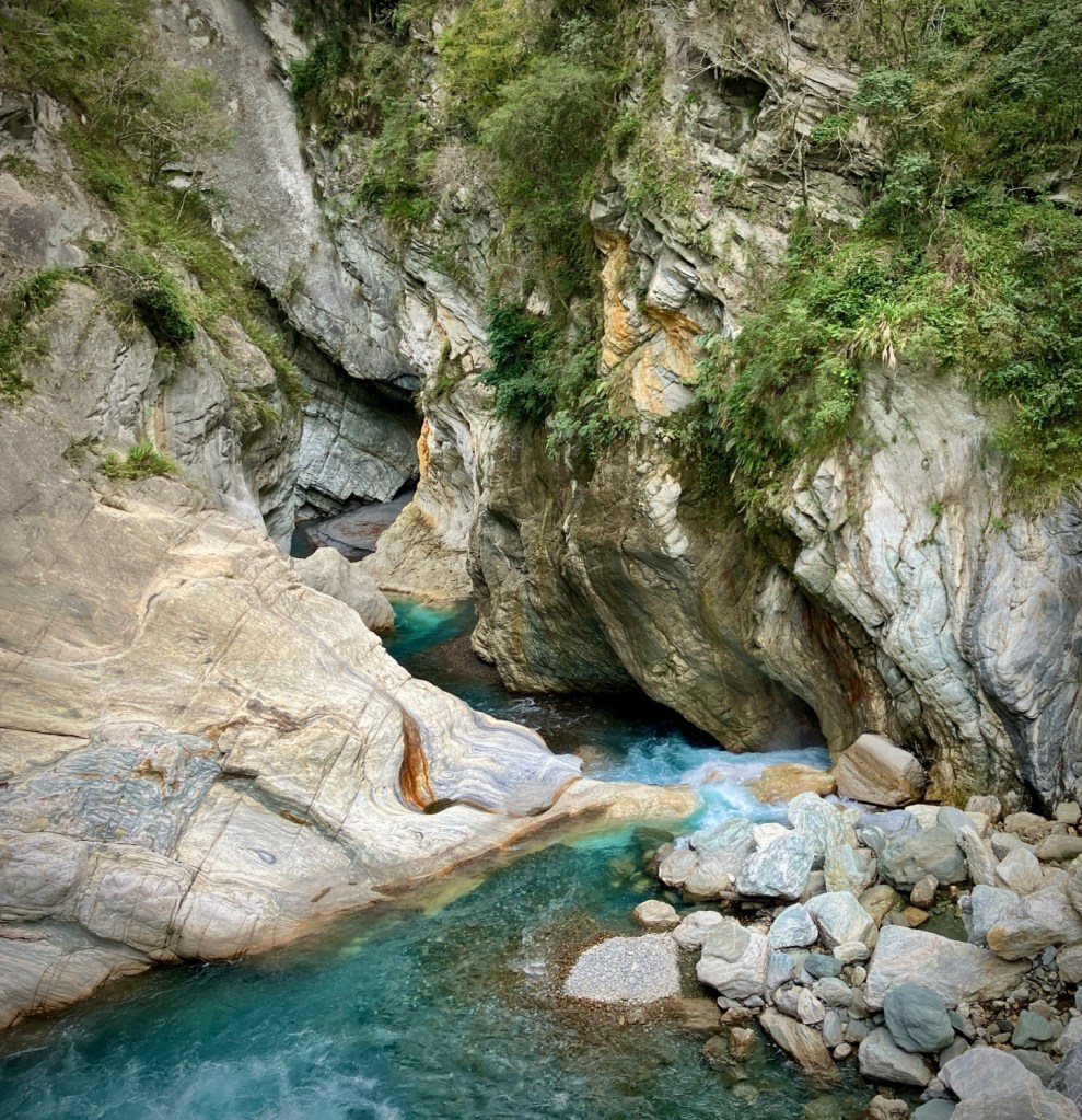
Taroko is a special place and we’re glad we made the effort, but can imagine with normal traffic and tour buses it may be a bit much. We also noticed that cycling is possible, as the lower climb is spread out over 30km or so. You would be rewarded with continuous views but do need to mind the many narrow tunnels.

Exploring the East Rift valley on rental bikes (Giant of course).
A surprise stop at an old Japanese temple. There is a strong Japanese cultural legacy on Taiwan due to its 50 years of occupation.

Next up was a short train ride to Yuli, where we spent two nights in a small hotel. This allowed us a full day cycling up to and exploring YuShan National Park. Much less visited than Taroko and the jumping off point for the Walami trail.

Oh how nice to be out of the cities.
Destination reached at the pleasant Liyu Lake.
A delicious indigenous influenced meal at the Liyutan Tree House near the lake. The preservation of indigenous culture is a priority on the East Coast where it survived longer due to its isolation.
Cycling in Hualien was fun since we were really the only foreign tourists about.

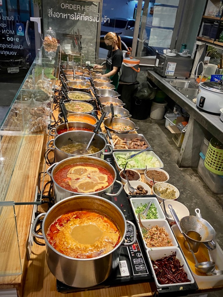
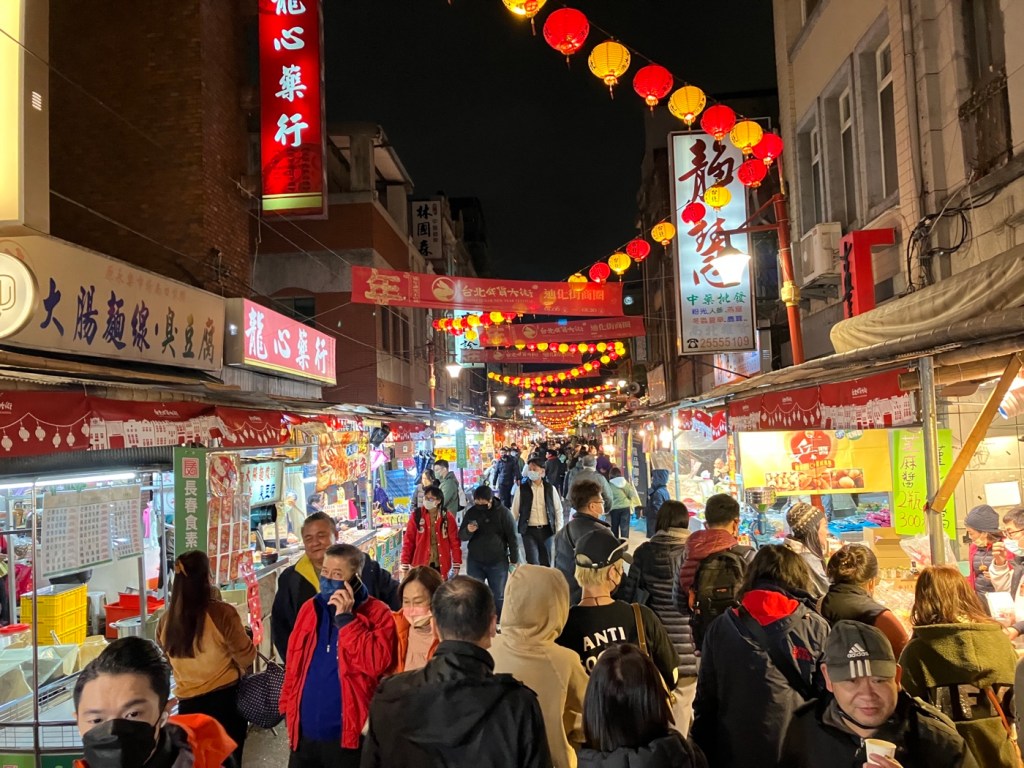
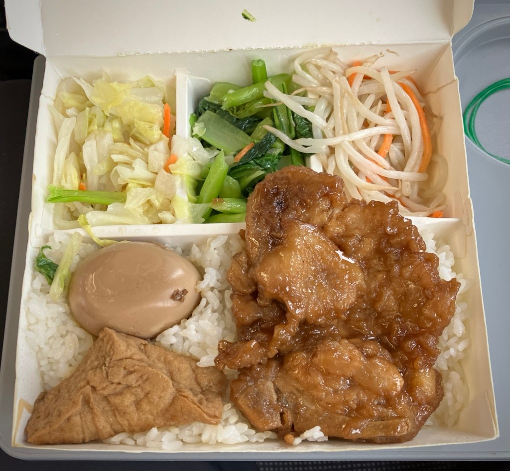
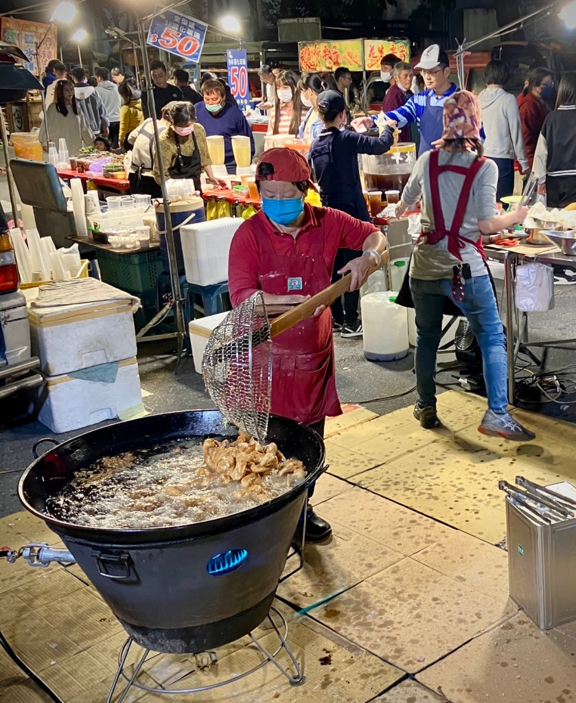
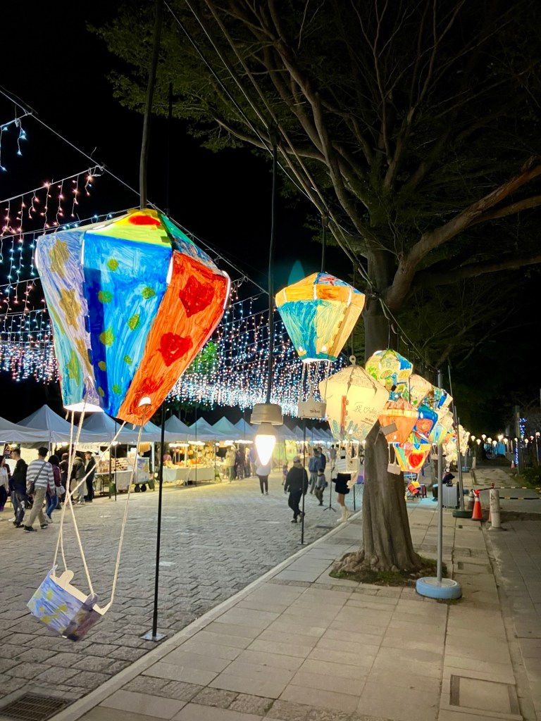
We’ve been eating well, but the food customs and timing can sometimes pose a problem. We have loaded up at some our breakfast buffets, which generally have many savory and healthy options. Lunch is a small restaurant/shophouse stand. Street and night markets are always an option but you need to be up for crowds and eating small things standing up at the edge of the road or against a building. We actually prefer food oriented streets to night markets. Oh, and good pizza is popular here, and a trusty traveler break from a lot of (excellent) Taiwanese food.

About our fifth beef noodle try, this one with the works of tripe and knuckle…mmmm!
Even the dogs know that scooters are the way to go in Taiwan.
This giant fried chicken vat amazed us at the most popular stand at the Yuli Night Market (Fridays Only!) .

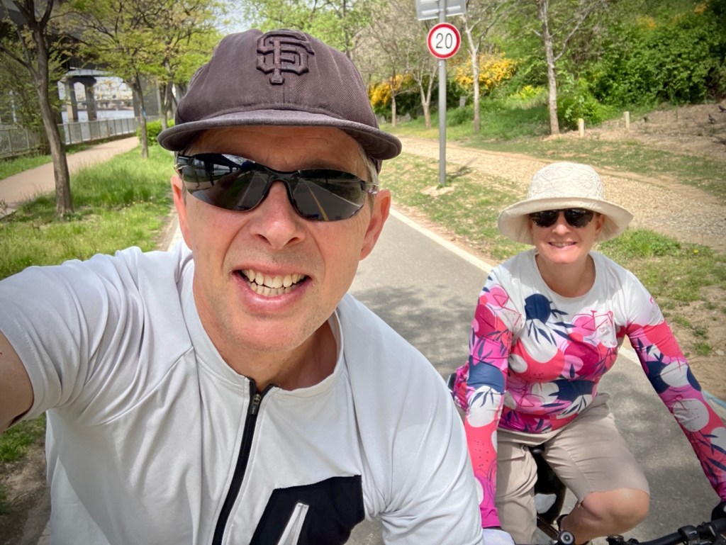
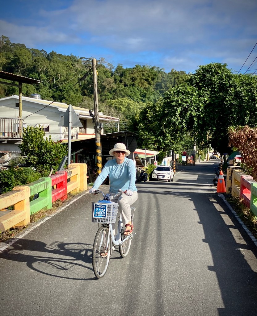
Yuli is a bit drab to be honest but the area around it is peaceful to cycle. Many of the Tawainese cities are spread out and walking not always the most pleasant as most locals use scooters to get from point A to B, they don’t consider long walking practical. We found it to be much better to bike from place to place and walk locally, especially when looking for restaurants. Small places on Google are often hard to locate, closed, or don’t seem to exist. But you’ll always find something and just need to stay flexible or pick a well established place with lots of reviews (including recent ones).

The area SW of Yuli is pleasant for cycling and a good way to get to YuShan.
Uphill, 5 speeds, AND falling rocks?’
Yea! we made it the official park boundary at El 1500 ft.
Suspension Bridge Number 1 and my number one travel companion -:).
Dizzying but stable.
I hiked in to this beautiful waterfall complex and suspension bridge number two while Cheryl enjoyed promised reading time!
The dramatic sea near Taitung.

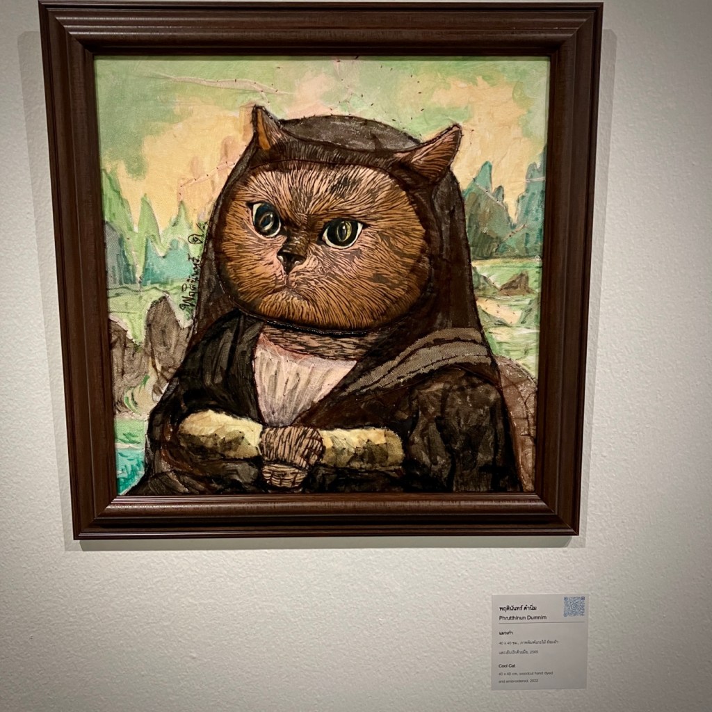
From Yuli, we had another short train ride to Taitung, where we spent another two nights. Taitung has a great museum of Prehistory on its outskirts that was worth a stop on its own. Although Taitung has a bit of an art scene by the old train station, if you are short of days, you might consider a stop at Taitung train station and storing your bags in the train station lockers to visit the museum (10-15 mins by taxi or bus, cafe or picnic on site) and then roll on to your next destination. Of course if you have your own wheels, then the areas north and south have lots of natural beauty and are certainly worth it exploring.

Taitung’s old railway station has been turned into a pleasant cultural area.

And alas that’s one of our limitations without a car or cycle touring here. We do miss a lot of the places in between, but we’ve balanced that by getting out of each region by bus or bike and seeing quite a bit. It really depends on what you like, and we do like cities. And we’re seeing enough, as experiences can be had anywhere.

Bye for now from Taiwan.

So we’re now on the west coast and heading back towards Taipei. The lunar new year buzz has started and we look forward to sharing more about our experiences soon. Happy travels!

Three Borders and an Infection…the Low Countries

Sometimes you are really in the groove of bike touring. The daily physical challenge, the rhythm of plotting our route, checking the weather, procuring food and lodging, and working in some fun and history along the way.

Trois Bornes: where Germany, Belgium, and the Netherlands meet. It also happens to be the highest point in the Netherlands at 322m.
Morning saddle-up at our little garden apartment in Miltenberg; a long travel day ahead.

You also tend to get a few bumps and bruises along the way; maybe bang your leg on a pedal or kickstand, maybe some chain ring grease, and always a few achy spots.

Our second train from Mainz to Bonn was a long local run and crowded from the get go, but we were able to wrangle our bikes against the wall…but way too late for proper seats.
Then even more bikes, including these two friendly German bikepackers heading out for a month ride to Nord Cap, Norway. Impressive!

You assume any minor nicks, scrapes, or pains will be eventually go away. And summer bike touring in the forests and fields always means nettles, bugs, and bug bites. So, as we headed out of our two day stay in Miltenberg, I still thought the growing red spot on my right leg would probably just go away…

Off the Train and headed towards Eifel NP.

Oh sure I was feeling a bit funky, but again, your body goes through ups and downs bike touring, so thought maybe this too would pass like an off day in the Tour de France. Plus we had an ambitious agenda to get us across Germany to a point where we could ride into unexplored regions of Belgium and Holland.

Cooling our feet in the Roer River near Heimbach, Germany

The 40k ride up the Main river to Aschaffensburg was fine and we had plenty of time to pre-board a local train to Mainz with our bikes. I had planned our route using local (RB/RE) trains that were covered by our €49 monthly tickets, and only boarding at the beginning of routes to ensure there was a spot for us and our bikes.

Bug bite infection now bandaged and first antibiotics in my system…still feeling apprehensive about a hot tough ride out of Eifel NP, but the doctor said it was ok to ride.
Wind turbines all over the Three Border Area as it’s ridges are windy!
Peanut butter and apples were our Sunday savior in Germany, when most everything is closed.
The Ravel bike route has great rest areas.
The rotating 24 hour pharmacy schedule in the Aachen area allowed us to fill our prescriptions on the weekend after a second visit to an urgent care and second opinion on antibiotics.
A rare and new bright urban bike lane in Germany. Happy to be heading out of Aachen…now doped up on two antibiotics!
After crossing into Belgium on Eurovelo 3, we appreciated the smooth pavement and well marked bikeway crossings and transitions.
The rail-trail Ravel route straddles the Flemish-Wallone border and is like sailing through the sky…highly recommended.
You know you are in Belgium…pavé!
A small defensive bunker from WWII. This almost classifies as a “pillbox”, which are smaller square or cylindrical defensive structures still found in the area.
A memorial to the soldiers who died defending the Vaals region from the Nazis in 1940.
The fragility of borders and freedom haunts us again in this region.

Feeling confident after our first easy train transfer to Mainz, we waited strategically on the platform for our next key leg to Bonn. As the platform got more crowded, we knew this might be a challenge, and unfortunately the empty train rolled in further up the platform than expected. Doh! As mobs converged, we quickly passed the first car marked with some bike space to find a better car. Big mistake.

Heading into Liege, a city in transition with new streetcar and brownfield development construction engulfing it for a few tough years. Visit in 2025!

However, it turned out to only have two bike cars; and by the time we got in the door of the second car way down the platform, it was crowded. People were already on the pop down seats in the bike area with large luggage. So after some fairly aggressive negotiating, we managed to squeeze in with our bikes and 8 panniers scattered about above and below seats and on top of our bikes. Poor Cheryl was standing almost the whole 3 hour endurance test of 22 stops; while I managed to find a seat for some of the ride in the main area, after asking two young men to move over and move their bags off the seats.

Heading down the Mass (Meuse) River. Goodbye to Liege and Wallonia.

So here is the thing about the €49 tickets; many trains are busier, but the long distance local runs covered by the tickets are especially popular. Next time we’d spring for the €100 intercity train with bike reservation on a trip this long…and you probably should too.

A water tap! Welcome to the Netherlands, there are almost no public water sources in Belgium or Germany.
Delightful Maastricht, Netherlands…we dipped into the Netherlands just for a night.
Mount Saint Peter just south of Maastricht is perched on a limestone hill; a quarry on one side and views of the Maas on the other.
Bikes everywhere around Maastricht University, home to more than 22,000 students.

But the upside of these adventures is that I ended up chatting to the two young men for an hour or so, after they offered me some cookies. It turns out they were both relatively recent refuges to Germany from Iraq and Syria and had fascinating (and somewhat heartbreaking) stories of their families’ trips via Greece and Turkey, where some of their family was still “stuck”. Again, they both said that they would love to go to the U.S. someday, but were ok in Germany, but not thriving. Germany has been overly generous in accepting refuges and should rightly be proud, but it’s a fairly rigid culture to assimilate into or even find your own community within the traditional Anglo-Saxon framework. Heck, we even find Germany a bit hard to assimilate into, so we can only imagine.

Even more toast chocolate sprinkles at the Coop to peruse…amazing how breakfast customs vary just a few miles over the border.
Survived the end of a heat wave with just a fan at the lovely and historic Hotel au Quartier in central Maastricht. Still cool compared to India and Sri Lanka!

So after a difficult exit in Bonn with less than helpful commuters plowing into the train before we could get off completely and refusing to move, we headed out to ride 25k up the plateau to a little B&B room at the edge of Rheinbach. We were mentally and physically shattered, but managed to buy some groceries for an easy dinner at our room and our hosts helped us out by cooking the frozen pizza for us in their big oven.

More familiar flags and some pride and appreciation for the sacrifice the US made in the mutual defense and liberation of Europe.
Great bike infrastructure continued as we
crossed back into Flanders.
Howdy train riders…this new Flemish bikeway is amazing!

So we headed out the next morning and I did sort of notice that the spot on my leg had continued to grow and was now over 4” x3”…hmmm? We made it to our next Guesthouse in Hasenfeld and decided, despite the heat; we’d walk down to try to see the lake. As we returned, we both realized my leg was brighter, redder, and the spot had a bullseye center. Yup, I needed to get this looked at ASAP, so asked the innkeeper about a taxi to a hospital about 30 minutes away. When I pointed to the red spot on my leg; she exclaimed in horror “Scheiste!” or some hybrid of shock in her German-Polish vernacular.

Reward for an 85k day goal reached; a short walk to a neighborhood brasserie for wine and a luscious Belgian beer near Mols, Belgium.
The next day, a 75k meander to Antwerp primarily along the rural Kempenroute in Northern Flanders.

Her panic did not help. It was now Friday evening, but she was as able to get us a taxi to the urgent care clinic of the local hospital, and I was seen in less than an hour. The doctor spoke English and was pretty sure it was an infected bug bite (but not a tick) and prescribed an antibiotic course and ibuprofen. He recommended I get it looked at again in the bigger city of Aachen; where we planned to cycle the next day.

Antwerp Central.
Now THIS is a train station.
Wow!

Feeling mentally better with the antibiotics, we headed to Aachen on a scenic route along the Rursee, one of the largest reservoirs in Germany, and then up and over the next ridge, and finally a blissful coast down the Ravel rail route to Aachen. In Aachen, we visited another (more crowded) urgent care on Saturday evening and the Doctor seemed to have a different opinion on which antibiotic was best, so started me on another course, as well as some prednisone, to quell a possible allergic reaction to the bite. Given our (rushed/efficient?) 7 minute visit and her lack of spoken English (and super fast German), we are still not entirely sure of her opinion, but I did have a new prescription and was able to start on her advice the next morning. The amazing thing about antibiotics is how fast they work as I was already feeling better by day 2, and by day 3 the redness had dulled, and dissipated completely within the week. Not sure which antibiotic did the trick, but have been re-boosting on yogurt and other pro-biotic foods ever since.

Multi-modal and car-light Antwerp.
Streets are for people in central Antwerp. It was bustling in the center…just not in this morning photo -;)

So thank you again German health care system for your kindness to foreigners. And by the way, the TOTAL walk in costs, €70 (two urgent care visits), €40 (4 prescriptions), and €140 for taxis. No insurance needed. Yes, the taxis were more expensive than two urgent care visits and drugs.

The recently renovated and highly recommend Royal Museum of Fine Arts in Antwerp puts the Dutch Masters in context with modern works and a great audio guide App.
The port area of Antwerp… with two ships on the horizon? Nope, on the right is the stunning Port House designed by the late Zaha Hadid. On our list to visit next time!
Sculpture snack break.

So after a Sunday rest day in Aachen, we headed out on our journey towards the Belgium border and had a great ride to Liege, in the Wallonia region of Belgium. Liege has a lot of potential and we didn’t get to explore much in one night, as the whole city is pretty much torn up for a massive streetcar and streetscape redo well into 2024. From there we had an easy ramble down the Maas river to Maastricht, dipping into the dogleg of the Netherlands for a night.

This “bikeways first” rural road layout makes car drivers work it out in the center while bikes get two wide lanes.
And bridges AND tunnels designed with separate bikeways.
Crossing the Oude Maas River near Dordrecht.
Mind the freighters please.

Maastricht is a lively Dutch city dominated by a young (est. 1976) but highly respected state university. The vibe is very international, especially as over half the students are foreign. Feeling 100% now, I next plotted a 160k two day route to Antwerp across northern Flanders. We noticed that the bike infrastructure in Flanders is nearly equal to that of the Netherlands, as there has been a huge push to catch up to that high standard the past 20 years. Belgium also felt a bit more sophisticated and gourmet than many of the smaller places of Germany and Czechia we had spent the last month.

Enjoying the culinary diversity of Rotterdam at Restaurant De Smaak van Afrika.
And more traditional, but delicious fare at Cafe Pierre; Dutch bitterballen, mushroom risotto, and a goat cheese and fennel tarte tartin (frites and bier a given…)
Rotterdam is the largest port in Europe, so bridges, tunnels, ferries, and these typical water taxis provide key links.

I think Antwerp is one of the underrated and overlooked gems of Europe. It’s bustling, has amazing architecture, great international food, pleasant neighborhoods, and fantastic museums, such as the KMSKA and Red Line. From there, we rode two days to Rotterdam, another interesting city, although more focussed on the future and modern architecture as it was completely rebuilt after the devastation of WWII. Yes, we love the “B cities” of Europe, especially in peak tourist season. You get a more genuine experience with fewer crowds. And you can you usually get a seat, even at the most popular cafes.

Off again towards the Hook of Holland.
Time for a quick sightseeing ride around Delft on the way to our night ferry.

Our rest day in Rotterdam was well timed as heavy rain came through, perfect for exploring the Harbour areas and fantastic Dutch Photography Museum. The next day, we finally set out for our last destination on the continent, the Hook of Holland, for our overnight ferry to the UK.

Water on all sides; about a quarter of the Netherlands is below sea level, yet somehow seems closer to the sky.

This is our favorite crossing to the UK as the Stena line is well run and bike friendly. You check in with the cars and ride onto the main car deck to park your bike, and then plenty of time to enjoy a drink in the bar, have dinner, and catch sunset as the ship sets out about 10pm. Then up to your cozy cabin to sleep. And then cycling off the ferry to our next adventures. Stay cool and note our next post will be soon!

Enjoying the late sunset with my favorite traveler as we pull out of Hoek Van Holland.

Mega trail around a mega city. Seoul, Korea.

A view from our first mountain park hike.

We knew that Koreans love to hike. Even if we hadn’t known that before coming to Seoul the sheer quantity of hikers using the metro would have tipped us off. Boots, backpacks, hiking poles, sun hats, we felt right at home with these transit enabled hikers. We hadn’t planned on turning our time in Seoul into a multi day hiking expedition, but that’s the joy of travel. Sometimes you just never know what’s going to happen and what you’ll find in a new place.

A view from our second or third mountain hike.
A view from the Seoul Trail.

You may be realizing that what these views have in common is that we are looking down at the city. Down as in ‘we climbed a lot of darn steps to get up here’.

Looking at one mountain park we climbed, the little one to the right, while climbing another mountain park. Playing the game called find our high rise.
The air was quite clear on our first hiking day. Rain was coming in a few days so we hiked three days in a row.

Rich found the first hike for us by seeing the mountain park from our 12th floor window and navigating us there hoping there would be a trail. There was. And there was an amazing accessible boardwalk style trail all the way up to a temple and a cafe. Maps.me was helpful, showing some trails, and Alltrails had some as well, but lacking a great mapping site we relied on Rich’s wonderful navigation skills.

Once we were on the trails the signage was quite good.
Very comprehensive signage on the Seoul trail.

Since hikers are getting to and from their hikes on the metro, there are also signs to get you to the trails from the neighborhoods.

Turn here to get to the Seoul trail.
A comprehensive hiker sign. I like they have a backpack and a pole. And a big version in case you fail to see the smaller sign.
Seoul wraps around and up to some impressive mountains, when you get off the metro you see this. Head that way.

The signage and maps varied in detail, and confusingly played fast and loose with having north be at the top, but on the whole you were well taken care of, signage wise.

A big view of mountains and the trail networks. Including metro stations.
A map showing the 156 kilometers of the Seoul trail.

Not only was the number of trail opportunities great, the amenities along the trails, and the construction of the trails were impressive. Very nicely maintained steps, benches and picnic spots, restrooms, and my new favorite thing – carpeted trails. It looks like jute, or coir, and for stretches that are steep up or down, or could get quite muddy, it’s super helpful. It also stops the usual trail ruts from forming, or the footsteps turning into hardened mud. And dang, carpeted trails – what’s not to love about that?

This one was new. You can appreciate the weave.
A more worn in stretch of trail carpet. And our much worn Ecco sandals.
Restrooms, clean and with potable water unless otherwise noted.
A pine grove with plenty of picnic benches.
Seating and shade.
An accessible trail gently climbs towards the view spot.
Where there were stairs they were also well built and maintained. And usually wide enough to handle the crowds of enthusiastic hikers. This was a weekday so there was not as many people as we imagine show up on weekends.
Rich heading up.
And up.
And then down. This hike day, a section of the Seoul Trail, had about 2,000 steps.

It’s not unusual for us to come to a city and skip the A list sights. Doing things we love to do, like hiking or biking, or even just walking city streets, gives us more insight into what life is really like in a place like Seoul. Seeing the neighborhoods far from the tourist friendly zones. Going into restaurants with basically zero idea what kind of food they serve. And hiking trails like these, full of locals. I tell Rich he’s never happier then when there are zero other western tourists. I developed a rating scale for him of tourist bombs – a high of five is a lot of tourists and not going to result in a happy Rich, and a low of one is good, but zero is better. After the tourist bomb rating is the wide eyed locals rating – which shows how surprised the locals seem to be to spot two big foreigners on their trail or in their small neighborhood restaurant. Our best hike was zero tourist bombs, and five wide eyed locals, the highest rating possible in my new rating scale.

A friendly fellow hiker. Even with few common words he and Rich got along over pointing out buildings.
This is a typical hiking outfit for the locals. Rich’s is not! Our sandals were definitely unusual.

In addition to good trail signs, there are informational signs about archaeological sites, and signs asking folks to please not collect acorns and chestnuts as the wildlife depend on them.

Good informational signs with english translation.
This cute squirrel would like you to leave their food alone.
Another reminder to leave nuts on the ground for forage.

You might be thinking, ok, so that’s all impressive and interesting, but lots of places have trails, and signs, and views. Well hold on to your sun hats, there’s more.

Stamps! Like the stamps we didn’t collect along the Seoul to Busan bike route, and in Japanese train stations, there are also stamps we didn’t collect along the Seoul Trail.
So cute. Each station has a unique stamp.
These. What are they, you ask?
Compressed air blowers. To remove the dust from your shoes and trousers before you head back into civilization.
The sight of these meant you were nearing the end of your hike. Or a connection out to a neighborhood or metro station.
Felt nice to dust off our sandals and legs.
Rock stacking. In California this is discouraged behavior, but here it has Buddhist origins, although some folks apparently just like the challenge, adding a rock as they walk by.
Ribbon blaze markings, so you can keep to the Seoul Trail at crossroads.
A group of adorable young hikers, an entire class went by us, greeting us in Korean. We were charmed.

The unexpected pleasure of hiking in Seoul was highlighted by all the amazing views. As you climbed up, wrapped around, or climbed down a mountain park, you got new views of a different part of this mega city.

A view across graves to a cityscape and another mountain.
This high stretch reminded us of Desolation Wilderness near Lake Tahoe.
But we never had views like this in Desolation.
Scrambling down towards the city and a metro station.
Getting closer to civilization and lunch, passing by a community garden site.
The reward? Tofu Bibimbap. It was delicious and I let it sizzle in its dolsot (Korean stone bowl) so the rice got nicely crisped on the bottom.

I want to include some tips for hiking in Seoul: Keep your metro card charged up, all the hikes we did are transit friendly. Bring snacks or lunch, the smaller neighborhood parks might have a cafe, but the longer trails that we hiked didn’t. Bring water, we were able to refill on all of our hikes eventually, but bring enough water to last for most of your hike just in case. Now, how to find hikes. You can assume that every mountain you see has trails, but finding a trailhead might be a little tricky. Rich used a combination of google maps, maps.me and All Trails. You can find information about the Seoul Trail at English.Seoul.go.kr and on our links page. If you find yourself confused, ask a local or follow someone in hiking gear.

The happy hikers on one of our Seoul hikes.

We’re at Incheon Airport now, slightly dreading the 12 hour fight to the US. I will definitely do a post about the food we ate while in Korea. The good, the not my favorite, and the mysterious that Google translate failed to help us understand. See you soon San Francisco.

Seoul to Busan by Bicycle! Mostly…

The infrastructure on the 600+ km Cross Country Trail is frequently jaw dropping

South Korea’s rapid industrialization in the past 40 years has been astounding. It’s an economic success story and now the 15th largest economy in the World. In addition to technology and manufactured goods, it now exports its pop culture, with K-pop and K-culture huge global influencers, especially in other Asian countries. Taiwan was visibly crazy for all things Korean when we visited in January.

Getting ready to tour at the Sunbee Hotel in Insadong, Seoul
Ready to go. We picked up rental panniers the day prior so we could pre pack and then drop our excess baggage at the shop to be forwarded to Busan. Very convenient.
A quiet Saturday morning subway ride to the bike shop

We are really enjoying Korea, but for different reasons than Japan. There is an somewhat frenetic energy here combined with a refreshing lassiez faire attitude towards many aspects of life. And again I’ve been awestruck by the differences in cultures just a few hundred miles across the Sea of Japan. Completely distinct cultures. Queues and formalities matter a bit less. And we’ve enjoyed exploring a vast array of Korean foods that we’ve never encountered in our limited Korean food dining in the U.S. There is so much more than Bibimbap and BBQ.

Rental bikes ready outside BikeNara. Now how do we get to the river?
On the North Side of the Han River Path. Now this is nice!

We haven’t found as much of the coziness and singular intensity of Japan here yet. It’s certainly here, but not as prevalent. And the young folks seem to have a very different outlook than their parents, and they are visibly two worlds away from the Korea their grandparents grew up in.

We’re bike touring again, yea!
The amazing infrastructure begins as we cross to the path on the South Side of the Han. Complete bike and ped paths run on both sides of the river through Seoul for over 20 miles!

They’ve also built some amazing infrastructure, including a massive national flood control program to tame the four largest rivers and make life in their paths more predictable. Part of this dam and flood control program included building long distance bike routes. The complete Cross Country Route is the most famous and runs about 650km from Incheon to Busan. We’ve wanted to check it out for a long time and luckily, there is a bike shop in Seoul that rents touring bikes and panniers, which was perfect as our beloved touring bicycles are half a world away now in France.

Pop up convenience stores and cafes along the busy stretches of the paths in Seoul. Very cool.
And benches to take a break to watch the kitted out roadies of Seoul on a Saturday
Convenience store Kimchi Gimbap rolls (pork
or tofu) became a staple for me along the route…a little less for Cheryl.
But add a crunchy Bugle-like corn snack to the top of the Gimbap and you’ve got a winner.

The challenge for us was the fact that, short of about four days on bike shares in Japan and one speed clunker rentals in Sri Lanka, we’ve been off the bikes for 4 months, and 7 months since last touring! So, after a few days exploring a bit of Seoul, we set out by subway to the bike shop, and traded one consolidated piece of luggage for bikes and panniers. We had the bikes for 8 days, but well over 600km to cycle. Yikes.

Still smiling despite a pretty fierce headwind on Day 1.
A big Sushi dinner after a shortish first day due to wind, a stop at Decathlon, and lack of identifiable lodging for another 50km.
Ready to start Day 2 after our first night in a love hotel in Hanam City, still in the massive Seoul metro area.
Sneaking out the discreet parking access of another love motel.

We had both brought along one pair of good fitting Lycra bike shorts from SF, as well as a long sleeved Jersey that served Cheryl hiking, and outer shorts that have served me for workouts and hiking in our travels. But that’s it for touring gear, as we didn’t want to lug a bunch off extra items for 4 months, just for a week of touring. So we bought gloves (can always use another pair) a few water bottles, and I picked up a new touring jersey with back pockets (a ‘must’ for touring IMO).

A bit of construction along the way, but always accommodated.
Although this was worrying.
But Day 2 amazed us through the most spectacular infrastructure stages of the route.

So fitness was one challenge, lack of kit another, and third, and most importantly, the fit of the bikes. My Giant aluminum bike fit me ok as the XL frame generally worked for reach and height, but Cheryl’s bike had too long a reach and low handlebars. Of course, both bike seats were new to our rear ends, which can always have unpredictable results…

Covered cabanas with river views.
So many bike bridges.
And 10 tunnels restored from the old rail line.
With artful lighting inside.

But the bikes were otherwise decent, with good disc breaks, tires, a decent gear range, and a rear rack. We missed our Ortlieb front handle bar bag and fenders, but bought a some cheap top bar bags at a Decathlon.

Multi-modal corridors along a lot of the River basins
The official signs helped navigate the Four Rivers Path (aka Cross Country Trail).

The cycling was about 75% on separated pathway and the route was beautiful and varied. Bridges, tunnels, dams, viaducts, and boardwalks were everywhere, making the route really fun to ride. It’s an impressive network and we felt like we saw so much of the untouristed interior that most people miss, especially once beyond massive Seoul.

Just when I need a sign.
Convenience Stores are everywhere in Korea.
The spring beauty continues along the Namhangang River. The flowers are lovely too.
Lunch stop…yup, Gimbap again!

It was mostly pleasant, but a few stretches were very industrial, including many of the larger cities with lodging along the way. You really get a taste for the vast mountains of Korea, and the vast industrialization that has powered their unprecedented rise to the first world.

Airplane or flood control…the taming of the four rivers takes a lot.
This engineer is impressed.

There were also some surprising challenges with finding lodging, as we were booking on the fly to allow for weather and other variations on daily mileage in an unknown world. But without a Korean Credit Card, only Agoda worked for booking. Other sites exist but have few listings. And we could do a whole post on Korean Love Motels (often called Hotels) but let’s just say they are a staple of lodging outside the biggest cities and vary from unsurprisingly cheesy to a more streamlined business feel. If you cycle tour, you will likely stay at one (or three as we did). They are generally clean and safe, and many rooms resemble super hi-tech man caves more than a honeymoon suite in the Poconos. One of our rooms was pretty nice, including amazing 65” UHD smart TV!

And the day ends with a rewarding dinner in the SunValley Hotel in Yeoju, not a Love Hotel and bike friendly!
Day 3 right onto the path outside the hotel

But we soon got into the groove and really enjoyed 5 days of challenging riding. On Day 6 though, we decided to look at bus options to get us closer to Busan as we were both a bit tired and didn’t want to risk longer long term effects of tendinitis in my knees or Cheryl’s wrist (our weak points). We had figured out that we wouldn’t make it comfortably to Busan in time to return our bikes, and wanted to avoid the last day of heavy rain predicted. So we rode to the main bus depot in Gumi and caught a bus to the outskirts of Busan, saving us 150-200km of the trail.

Wow, more flood control awesomeness
The trail profile is deceiving as many places have small ups and downs that add up, a few stretches that require dismounting.
Slight Detour to our favorite convenience store chain in a farm town.

A great thing about cycling in Korea is that almost all long distance buses take bikes without charge or hassle. You just throw your bikes in the luggage compartments underneath. You’re usually no more than 20 or 30k from a bus depot, although they can be off the trail a few km or 30 depending on the segment. There is lots of info online about buses and routes, and I found KoreabyBike.com useful for an overview and general info related to the long distance trails.

Signage was sometimes tricky.
We ride on, a little flatter but still some headwind…but we could use a boost…
Like a surprise dumpling cafe on the trail!
And then met some friendly Australians (living in New Zealand) to chat away the clicks!
Kate and Pete were great fun and energetic, and had a friendly Korean film crew following them for days in a tourism plug. We’ll see if we made the cut and hope to meet them again.

Another great thing is that water, bathrooms, and convenience stores are frequent. The surfaces are generally smooth and road grit and glass was not a big issue (No flats or mechanicals for us -:). This all makes it less stressful, and makes up for the challenges of language barriers, quirky lodging, and unfamiliar food in small cities and towns.

Awesome bathrooms Korea.
The glamorous start of Day 4 from another love hotel parking lot in Chungju.
Day 4 brought rain, cold, and two mountain passes…plastic bag travel hack being installed in a great bus shelter (with sliding doors!).
Up the big climb of Ihwa Mountain pass in a welcome lull of the rain. There was so little weekday traffic that we could easily ride in the smooth road instead of the patched bike lane.
And up.
Plastic bag booties on our feet and under our bike shorts helped a bit on the 43/6c decent in the rain…but it was cold.
The days profile…Ihwa mountain pass is sort of the N-S continental divide of South Korea; separating the Han and Nakdong drainages.
A chance to warm up climbing to one of the many cultural points of interest along the way, such as these ancient Buddha cave carvings.

But we are so glad we did the ride and are happy that we were able to get back a bit into our favorite touring groove. Nothing beats rolling down a winding path through unfamiliar terrain, never knowing who or what is around the bend.

A surprise public hot spring foot bath saves us for the home stretch of Day 4. We took about 20 minutes to thaw our feet and hands.
More rain but always surprises to keep you going.
And some pork and tripe stew to warm us back up that night.

By the way, navigating in Korea is not always easy as Google Maps does not really work due to strict server data hosting laws. Google maps won’t give you cycling or walking navigation. And the two most popular Korean Apps, Naver and Kakao, only take a bit of English, so you need to try to constantly cross reference names and Hangul script. Or, pick something near where you want to go on the Korean apps that is identifiable. And note we found the cycling routes suggested by Komoot in the cities to be better than Kakao, as Kakao often routes bikes on arterial sidewalks.

Day 5 into Gumi includes a kilometer of river viaduct and finally a strong tail wind!

To be honest, at first brush, Korea felt a little harsh to us after Japan and Sri Lanka. We also have been disappointed to see Korea’s embrace of long distance paths, but not urban and everyday cycling as a culture or significant solution to transport in cities, even small ones.

Bus tickets to Busan
And no zombies on the bus.

It was often a bit hairy off the paths, especially in Busan, as there is very little accommodation for cyclists in most places. And consequently very few urban or suburban cyclists riding for transport. This a huge difference from Japan, where cycling in small cities was a staple, albeit on somewhat substandard shared sidewalk paths. They have some shared sidewalk paths in Korea, but most are too narrow and too pedestrianized to be practical.

The paths and countryside are so nice, but haven’t extended to city infrastructure
The main bus station was 18km north of our hotel in Busan, so we were glad to be able to ride some of the Oncheoncheon corridor
It reminded us of the amazing Cheonggyecheon in Seoul, but you can cycle the Oncheon. Both were restored in the 2000s
Off the trails, there was little space for bikes
Day 7 smiles as we rode another 18km to the bike shop…Busan is huge.
Backstreets are your best bet in Busan
Easy return at the partner bike shop.
Bikes and panniers gone, now back to the subway.

But the country and its people have really grown on us. Cheryl will share more about our other experiences, including our 10 days in Seoul, a city that has way more to offer than it first presents. We are also pleased to see that President Yoon and his wife visited the Bidens recently in Washington DC and that the two countries have strengthened a strategic partnership and resolve to protect democracy.

The Busan Chicken was everywhere, plugging for Busan’s bid for the 2030 World Expo
Enjoying the buzzy Busan nightlife in Seomyeon.

South Korea is a great friend to keep close, and not just because they are so much fun to hang out with.

Happy travels and happy pedaling!

The colorful buses of Sri Lanka.

My first bus photo. On a walk from Jungle Beach, near Galle.

Another thing to file under “Wasn’t expecting that!” The buses of Sri Lanka are eye catching. Very eye catching. Day and night they burst with color and bright decorations and lights.

At the bus station in Galle. After I snapped this photo the driver came out to wave at me.
In Kandy. Rich added for scale. The pink paint job and headlights which look like eyes!
Looking in the front door. That is some operator’s seat.
A side view of the pink bus in Kandy.

Not all the buses were so exuberantly adorned. There are state buses (with staid, some might say boring, paint jobs), and private buses (wow! Not all are wow, but a lot.). The private buses are licensed for a specific number of runs per day, this means they linger a bit at every stop hoping for more passengers.

In Kandy. A Tata bus. Most are Lanka Ashok Leyland, which seems to be a joint venture with the Indian company Ashok Leyland.
Kandy again. An awfully hot walk from the train station took us along bus row.

Did we actually ride the buses? No. We took trains when we could, but on routes with no trains we hired drivers. The buses looked pretty chaotic, and a few tourists with rental cars we spoke to confirmed that the buses are bullies on the road.

My favorite bus photo. Kandy again. This gentleman is ready for the buses of Sri Lanka calendar photo shoot.
In Colombo. She looks fairly straightforward from the front. The tassels along the door hint at what’s inside.
A peek inside the open door.
Come on in, invited the operators. They are a school run bus. They drop the school children off and wait to take them home.
I’m quite certain that no transit agency in California would allow this level of decoration.

In addition to a bus journey taking a long time, it is recommended that you don’t put your luggage down below due to dust and mud, so you must pay for an additional seat and face the wrath of your fellow crowded in passengers. We decided that we didn’t need to experience the buses of Sri Lanka as passengers.

Colombo bus traffic. You can understand how important these buses are to life in Sri Lanka, so many buses.

It’s easy to criticize or second guess a country’s public policy and governance, and Sri Lanka is working through a lot of challenges, but transportation is the lifeblood of any city, and even more important in rural areas. For the sake of the people of Sri Lanka I hope the announcement that a recently announced purchase of 500 new buses shows a commitment for improving transit. Many of the old buses are gross polluters.

This wraps up my bus post. Once a transit geek, always a transit geek.

Farewell India

India was incredible. It’s so overwhelming in its vastness, yet can be so friendly at a smaller scale.

Sunrise in Mahabalipuram, Tamil Nadu

There is nowhere we have experienced a broader range of moods. The many highs are unforgettably etched in your brain, just next to the pungent lows.

Happy to be off the roads and in the relatively safety of a train from Kollam to Madurai
Exiting our 2AC car in Madurai…there are 2 berths parallel to the windows (left), but better to be in the 4 berths perpendicular to the windows for sitting.

And in our fourth week of a big circuit of southern India, it continued to surprise us. It’s surprising that it works at all. It’s a global blessing that it’s all relatively peaceful, given the religious, cultural, and regional diversity. Let’s really hope this does not change.

The new 24/7 car free promenade in Pondicherry. So well used, especially mornings and evenings
Spirituality and commerce meet outside the Manakulu vinayagar Temple in Pondicherry
Pondicherry’s green and pleasant street
Bikes were fairly plentiful in Pondi and Auroville, but no bike accommodation yet.

It’s also fascinating to see how people have adapted to cope with it’s challenges. Vagueness and bureaucracy are endemic and seem to be the enemy of progress. Yet the dynamic new tech and innovation sectors are amazingly efficient. Two worlds.

The stunning carvings of Arjunas Penance from the 7th century reign of Pallava king Narasimhavarman I.
The immovable? Krishna’s Butterball
Carving in hard granite is why these outdoor treasures have survived 14 centuries
Cheryl is impressed by the Trimurti Cave Temple which depicts the Hindu “trinity”.
Mamallapuram Hill is an amazing spread of carving prowess and temples to explore, with relatively few visitors.
1400 year old bathtub!
It stunned us that the inside of the archaeological park had so much trash, despite quite a few staff about and controlled entry.
Cheryl gets hired as photographer at the dramatic shore temple in Mahabs.
The sights are fascinating in Mahabs, but the town core feels like a faded travelers hub past its prime. Cleaning up the trash would help a lot as underneath is a beautiful place
Pallava Beach near Mahabs, the most uninterrupted waking we did in weeks.
A large wedding boomed into the night at the resort down the beach from town, complete with fireworks. Unfortunately; we did not get invited to the wedding, but certainly heard it!

One surprise of this visit to me is the fact that so much of the old world and customs still dominate life outside the metro areas. I thought things would have changed a bit more. Municipal services still don’t seem to be strong. Public spaces are not cherished and although cleanliness in the home is paramount, keeping common spaces trash free is still a difficult thing to experience for people used to more proper sanitation (and much more consumption per capita, but just better hidden!).

The intoxicating colors of funky Mahabalipuram (“Mahabs”).
The rather ominous street name for our guest house in Mahabs. Trash is everywhere.

But as much as I have been intoxicated by the new metros, sights, sounds, and conversations with so many kind and interesting people, I was equally aghast at the state of road transport. It’s hostile, aggressive, dangerous, and classist. The National highways are death traps and have 30% of fatalities despite only representing 2% of the road system. Our last week really highlighted this as we had 3 road transfers in a row to navigate the center and east coasts of Tamil Nadu. In some cases, buses were an option (with additional transfers on each end), but the buses are also dangerous.

A colorful house and Rangoli in Mahabs
A leafy view towards the Bay of Bengal from our balcony at the Blue Moon Guest House
Bikes are still used for utility in Mahabs

So my advice to future travelers is to avoid the roads as much as possible…book your trains early and plan your trip around them. When you do need a car transfer, only do it by daylight and make sure the car is decent and has working seat belts. I can see why people choose a nice driver or transfer van tour option. Of course you can ask your driver to drive slower or take fewer passing risks, but this can tough to overcome with language barriers and the endemic mania that are the norm of Indian roads.

The Matrimandir, the meditation hub of the 55-year old community of Auroville outside Pondicherry.
Auroville is a popular place to visit for Indians as it’s been a relative success story in communal living and environmental stewardship.
Yup, I too was enthralled by the banyan tree, the geographic center of Auroville.

And to be honest, a majority of people in cars were just plain mean, and generally have low respect for pedestrians. It was pretty horrible and stressful, and degraded the quality of life in places such as Ooty. It is unhealthy to body and mind. And as Cheryl likes to note, it has the biggest impact on women, who seem to be the majority of pedestrians walking on roads to conduct their daily duties…. and there are many duties.

The new Chennai Metro. Clean and efficient, with about 50km now, but another 100km in the works. The cities are changing.
One of 4 exits of the Chennai Lic Metro Station – with the requisite raised entrance for flood protection.
Tidy new metro left. Chaos right.
I was lucky to find this busy street food stall just down from the metro and asked a friendly local what he liked.
Le menu du jour
A Bread Omlette it is. Tasty and so satisfying at a mere 50 cents.

It’s a tragedy of the commons. We did see a few feeble attempts to influence behavior with messaging, but unless a massive and systemic change is made, it may only get worse as more cars are added to the mix.

The cows are so friendly and chill

But we are so glad to have made the journey back to India. it’s added to our understanding of its challenges and boosted our appreciation again of the daily struggles of so many. It gives us both hope and fear for two disparate futures.

Sunrise on Rock Beach in Pondicherry

Thanks to all those who shared their kindness along the way, and we wish you all the best. Keep in touch.

Goodbye for now India

Chaos and Calm in Bangkok

This is our fourth visit to Bangkok. Bangkok is unique, fluid, and always changing. And we always look forward to further exploration of this vast and fascinating city, built over the swamp and floodplains of the Chao Phrayo River.

The Bangkok vision of a green city…from Benchakitti Forest Park

A lot has changed over 17 years since our first visit. There are new green spaces, MRT and SkyTrain extensions, and dozens (hundreds?!) of new malls and high rise buildings. But in many ways it hasn’t changed, including frenetic streetlife, food, and more traditional low rise and open living in most neighborhoods.

Bonus meet up with our friend Charlie, who used to live in Bangkok, and now leads and organizes amazing safaris in Africa and Asia with Remote Recreation

But the pace of change in urban mobility hasn’t happened as fast as you would expect, or in pace with other big Asian and global cities. And unhealthy air, noise, and traffic are still major drawbacks to daily life. Some of this is due to challenging and unstable governance, some due to a slowing of the economy and the pandemic, but at its core, Bangkok is fighting a legacy of car and scooter dependence that has been coddled, accommodated, and supported by street expansion and lots of (mostly free) parking at every destination.

A slightly more orderly but still congested Bangkok in 2023

Of course, the addition of more highways and toll roads has helped overall capacity, and apparently even the continuous congestion and traffic jams of 2023 pale in comparison to the true chaos of the 1980s and 90s before road expansion and rail transit began.

Yup, this is where you walk…also the scooter lane, and unlike the narrow lanes of Europe, cars, vans, and SUVs are big here.

But it’s a catch up game, as the first SkyTrain (metro) didn’t open until 1999. Luckily, major development has been concentrated along transit corridors. And there are now 3 BTS SkyTrain lines with 62 stations and 2 MRT lines with 46 Stations. The buses seem to be a missed opportunity as they have little or no dedicated space and suffer in the congestion. These old buses belch a scary amount of diesel along the roadways into air often in the 150-200 (very unhealthy) AQI levels.

Up on the skyway…choosing the right station exit can save you time and the stress of crossing mega intersections

There is also an elevated driverless train line to the somewhat distant Suvarnabhumi (BKK) Airport that opened in 2010. These have all helped to reduce car dependence and expanded the reach of transit. But overall, the system is not extremely user friendly as the BTS, MRT, and Airport Trains are operated by separate companies, so ticketing is still separate and connections a bit clunky and congested. But it all works and much of the service is good. We just carried two fare cards and swapped out for SkyTrain to MRT trips, and bought an electronic single-fare token for our trip from the Airport.

Adding fare to our MRT tap cards…once you get the hang of it, it sort of makes sense. Minimum add is 100baht, but machines only take one bill per top up transaction. Quirky.

We spent a week here in 2007 staying with two different expat friends. Outside of India, Bangkok was our first big Asian city experience. It was a globalization boom time. (And possibly peak?) We were mesmerized by the chaos and modernity of the city, then one of the fastest developing in the world outside of China.

The travelers loved the new SkyTrain in 2007…so young!
Varied street life on the side streets…explore and you never know what you will find

At that time, we explored the country for 6 weeks, so saw the northern mountain regions, northeast rural and Mekong, and the southern peninsulas and fabulous islands. Like most western travelers to Thailand, we loved it. We stopped over here for 3 days in 2014 and 2017 as part of travels onward in Asia. Both follow up visits were enjoyable as we stayed in two different neighborhoods, but always close to a MRT or Skytrain station.

Chatuchak Park next to the mega weekend market of the same name has a great 3 km loop to walk and is very well kept with park staff on bikes. Yeah Bangkok!
Lumphini Park is the old main park of Bangkok…still a nice respite with trees, but nearby mega construction and a bit too much “stuff” in the park reduces its luster somewhat
Asian Water Lizards are all over the parks and canals of Bangkok, they can grow up to 10 feet!

So fast forward to January 2023….two coups, military leadership, a new King, global slowdown, and three years of a pandemic devastating the tourist economy which accounted for over 20% of the GDP in 2019. It’s still the second largest economy in Southeast Asia, but the stagnation is obvious and frustrating for the hard working and constantly striving lower and middle classes.

Canal paths are arteries of a calm and old style life in many neighborhoods
Some canals could link up neighborhoods, but most are neglected or cut off…definitely a future walking network opportunity

Its growth and development is still chugging along, but it does feel like it the benefits of mega projects, skyscrapers, and industry are not reaching the masses. The unfortunate decision in the late 80s to embark on a massive roadway expansion in the city instead of transit set the patterns that feel intractable in today’s Bangkok.

The Bangkok Art and Cultural Center is a fun and free space to explore in central Bangkok

On the bright side, a new central train station has been opened in northern Bangkok, that the government hopes to use as a hub of a vastly expanded rail network, with a specific goal for tourist service. Good plans if they can find the will and money to execute the plan.

The massive new Krung Thep Aphiwat Central Terminal opened January 19th
Me and the Royal Family approving of the fantastic new station

Thailand still seems to need more tourist (and other?) taxes to pay for infrastructure. One of the highly touristed (and beautiful) islands Koh Tao has instituted an arrival tax for each tourist to help pay for much needed sanitation and environmental improvements, but it’s a modest fee (<$1), so progress will be slow. Thailand itself is also proposing an international arrivals tax of 300 Baht (about $10) starting in June, and monies are designated for accident services and development assistance. It still seems light based on the impact tourists have on the infrastructure. We all love Thailand, so we should help pay to make it more sustainable.

Platforms and multi level concourse are inside the grand hall, but no photos allowed…
Striking architecture
Recruitment for new taxi drivers….but the station is also connected to two metro lines
Beautiful, but a little vacant on opening as this was built for the future; including HSR

But the most obvious deficiency in Bangkok’s transport network is walking and cycling. It’s shockingly disconnected. The artery and capillary (Soi) network is disconnected by design and development legacy, as well as many routes being cut off by the remaining canals. But dead end streets are the nicest to live on and bring quiet from the chaos, so the challenge is to expand walking and cycling networks without inducing car and scooter traffic. It can work with some clever bollards, gates, or chicanes…and maybe some scooter traffic is acceptable as this would shorten trips for many from the arteries, as a grid is established.

This is the way!
Yup, Soi 14 does go through …just barely, but a fantastic calm link south of Sukamvit
There is literally no space for bikes on most roads in Bangkok…only for the brave and determined
Kitty finds some calm under a pick up truck

So for us, this is a livability failure. The lack of connectivity has been recognized by some studies (See UDDC Goodwalk pilot plan) and a few small steps have been taken recently to improve pedestrian mobility, such as new ladder crosswalks and a corresponding law increasing fine for motorists violating ped ROW in them.

The calm of some of the alleys and sub alleys is a delight and an opportunity for connectivity at a human scale

It is a bit encouraging, but pedestrians are still mostly a sub-species clinging to gutters, dodging scooters, and navigating a pretty hostile, polluted, and unpleasant streetscape on the main arteries. On hot and polluted days, which are many, it makes even the most ardent walker retreat to an alternate means. Tree planting and protection does seem to be coming with new development, which helps everything, heat, air, and sun protection for walkers.

Oh, but the food is amazing and tasty and still and integral part of daily life in Bangkok. The Northern Thai casual restaurant Hom Doam.
Cheryl enjoying Khao Soi at the amazing Hom Doam in Thonglor
A Northern Thai food sampler at Hom Doam
A main canal, just west of the Jim Thompson museum house, has fast ferry service and connects to the river.

But indeed this a just a drop of perspective from a non-resident Farang, and I don’t begin to pretend to understand the complexities of life and culture here. But the local officials and planners do. And many are working hard to make the long vision changes to lifestyle and infrastructure that will lead to a healthier environment and people.

Great meeting fellow travelers Heather and Volkan for a long chat at Chamlong’s vegetarian restaurant near Chatuchak
Buddhist Temples can be prominent or tucked away in hidden spots throughout Bangkok
Green alleys to quiet living oases…if you could only keep walking

Bangkok is a complex ecosystem of 11 million people, and finding the balance of economic growth and opportunity versus health, pollution, and mental health is tough. But as Asia often looks forward, I’m hopeful that next time we visit bangkok we’ll see more positive changes. Already they are considering a congestion charge, expanding the MRT, and modifying laws to improve pedestrian life. Just don’t move too many of the food carts out of the way….we can walk around!

The happy travelers in Benchakitti Forest Park

Happy travels and on to Southern India!

Taipei 101 – An Introduction

I love the rush and excitement of flying into a new place. And since we transferred through Tokyo on ANA, we flew into the closer Songshan city airport (TSA) and had a window seat on a long double loop around the dramatic hills and skyscrapers of Taipei….a free aerial tour of the city where we would spend our next week!

Lunar New Year Bunny Seats on the 89th Floor of Taipei 101
Lost? You can almost always spy Taipei 101 wherever you are.

Note that most longer flights go out of the much larger and more distant Taoyuan International Airport (TPE). But both have good rail connections right to the center, so no worries if you fly into or out of TPE.

Waterfalls, mountains, and forest

Taipei is a world class city that just doesn’t rise to the top of most (western) tourists lists. But we think the Portuguese nailed it with the name “Formosa”, as it is a beautiful, prosperous, and free place.

Local Agriculture in the Pingxi District

It’s certainly a place that is receiving more attention in the global news due to the complex geo-politics associated with its status and ultra strategic location in the South China Sea. We enjoyed learning so much more about the history of Taiwan. It has left a unique legacy on the psyche of the country.

Ximen, The walkable downtown of Taipei

After the Qing Dynasty lost the Sino-Japanese War in 1895, they ceded Taiwan and the Japanese colonized and controlled Taiwan for over 50 years. When their occupation finally ended after World War II. a dictatorship initially led by Chiang Kai-Shek ruled for the next 40 years under the KMT party, with strict repression of free speech, detentions, and killings known as the “White Terror”.

Getting dizzy in Taipei 101
The massive damper on the 88th floor of Taipei 101 has a series of cute damper babies…this one was my favorite. Way to make science cute.

By the late 80’s, a slow transition to a more open and democratic Taiwan started, and after the election of the Democratic Progressive Party (DPP) in 2016, it has solidified its place as a liberal and forward looking democracy.

The Pingxi train and Shifen suspension bridge

They were the first Asian state to legalize gay marriage in 2019 and have 42%+ representation of women in the parliament as well as a female president. The Scandinavia of Asia?! Almost, but there is still a huge gender wage gap and other legacy issues of a male dominated business world.

Bali and Tamsui are easily reachable by MRT and ferry for seaside strolling or cycling

However, we could feel the positive energy and openness in Taipei, although all within a society that still values social stability and conformity. It’s an interesting mix but definitely a positive one to experience, even as an outsider.

Run Up to the Lunar New Year on Dihua Street
Cutest local fire station ever, Tamsui

Here’s the Top 10 reasons we loved our week in Taipei and why you might too:

1. The Food – you can see Cheryl’s last two posts for lots of details on the food scene…great food everywhere, and the amazing and exciting night markets.

Ready for the year of the rabbit
Food and SO many boba tea shops…Taiwan invented it and continues to reinvent it for the rest of the world.

2. Unique culture – fun and quirky with a rich history influenced by indigenous, Han Chinese, Japanese, and western culture. There is also a strong fascination with Korean pop culture and clothing. It’s not quite like anywhere else, it’s Taiwan.

Cute = Taiwan
Check in option at Tinguan Airport…no takers?
Cat/bartender at the Tipsy Dragon in Songshan

3. Efficiency AND Kindness – This is a neat and orderly city…people follow the rules and you will enjoy yourself more if you do too. Or at least make an effort. It’s an easy, extremely collaborative society, and everyone has built in empathy and spacial radar systems. You’ll never bump into someone or have them cut or push too much, even in crowds…it’s infectious and relaxing once you embrace the system.

Graceful and spacious MRT stations, many outside the core are aerial with quiet platforms, views, and pleasant breezes. No center running freeway noise here.
Stand right, walk left…always!

4. The MRT! – a comprehensive and modern system that carries 2 Million passengers a day. Buy a EasyCard (IC Card) at either airport station for 100 NTD (New Taiwanese $, or about $3 US), load some fare and then tap in and out like the locals for 50c to $1 a trip. We had the airport station agent add 300 to each to start, so paid 800 NTD. If you get a funny beep or issue with your card, there is always a helpful staff person nearby.

The MRT is integrated with neighborhoods, creating nice station area plazas such as this one in Shilin
Neighborhood pride in Shilin

There are also real time predictions at all MRT and most bus stops, so don’t be intimidated to use buses as well. Big numbers on the front…tap on and off with your IC card when you ride at the front or back doors. So easy.

Keeping an eye on train operations in Jintong

5. Bathrooms – Seriously, Taiwan is the most bathroomed place on the planet (interested to hear about others!?). Every station has one (or two), public parks, museums, attractions, malls, night markets, parking garages, busy neighborhoods….you get the idea. And all free and clean, which really does reduce travel stress and the need to go into “camel mode” walking about like in some counties.

Fun, inviting, and yes, bathrooms in Pinxi District
Always so close

6. Greenery – Parks, long greenways (140km of bike paths!), and lush hills and mountains make for a pleasant backdrop, plus potted street plants liven up even the drabbest streets.

Street plants seem to be a craze in Taipei and make the vast downtown neighborhoods a bit more livable
Ahead of the curve…the cool interchangeable scooter batteries of the Gogoro energy system
Alley greenery (and the ubiquitous Food Panda!)

7. Clean air – not perfect but good for such a large city due to great public transit, fairly clean vehicles, frequent coastal and island breezes, and the greenery noted above.

Spiritual moss on Jiantan Mountain
Building around tree or tree within building?

8. Safety – Traffic is pretty organized and street crime seems virtually non existent. One of our only social gaffs was inadvertently moving a women’s notepad/binder/IPad? from a back garden of a coffee shop…we thought it belonged to the shop, and she came out surprised to see us in her seat…we offered to move, but she refused and headed to another spot upstairs. Oops.

Pocket temple in Tamsui
More fun at the Onsen Museum in the hot spring town of Beitou…via MRT of course.
The historic Pingxi Train line runs 13km from Sandiaoling to Jintong runs hourly, so you can hop off and on or walk between stations.

9. Hiking and cycling culture – a great proportion of the world’s quality bicycles are made here (not to mention 90% of the worlds fast semiconductors), and they actually push cycle touring as a key component of their tourist advertising. On this first “winter” visit, we only grazed the endless mountain and forest trails that crisscross the spine of Taiwan… with many accessible by public transit.

Morning walk up Jiantin Mountain
You can walk from the edges of the city far into the mountains and take a train or bus back.
E-bikes for Spaniels…so green

10. Mixing with the locals – not many western tourists makes for a more exotic feel. And at least some English in most places makes interactions more rewarding. We’ve discovered this cool Asian capital, right-:)

Cheryl drying out one of the many cats of Houtong Cat Village
Cats keeping an eye out on the purpose built cat bridge in Houtong
Cat food on the cat bridge

Maybe you’ve been here and are nodding along, but if not, consider at least a stopover in Taipei on your next travels to Asia, or better yet, spend a few weeks or a month traveling around the whole island. Rail circles the island and the more developed west coast has a high speed rail network that takes you all the way south in about 2 hours.

So much to explore outside of Taipei…Shifen village between trains.
We only dabbled on the local trains, but there is a whole island to explore!

The more you learn about the people, history and culture, the more you will understand the how complex the geo-political conundrum really is. Our hope is strong for a positive future for Taiwan and we definitely plan to come back soon to explore by bicycle.

🐇🎉Happy Year of the Rabbit! 🎉🐰

Peace to all and happy travels!

What’s so great about San Francisco?

Gorgeous buildings with amazing paint jobs. A paint job like this is a gift to the city.
This deserves two photos. I’ve seen this house when that bare tree is exploding with bright fall leaves. Stunning.

Let’s start with the architecture. And the way folks paint their buildings. The four or five color paint jobs on the Victorians always take my breath away, this one in particular. So bold. And the fence! This is a tour de force of color and joy. I love this house.

A lovingly kept corner building. That awning. The color scheme.

I haven’t found a better city for just walking around and looking at buildings. It helps that since there is so much money in the City now, more people seem to be spending to spruce up the lovely old buildings. SF has a boom and bust history, a history of rising from the ashes, and the care for these exteriors you see must bear witness to a deep love for this City. With each brightly or carefully painted building the mosaic of the city is enhanced.

Even when clad in more subdued colors these buildings charm.
Nighttime glamour. I’m glad I got this photo, that huge Christmas tree in the window was gone the next day.

Great buildings- check. What else makes San Francisco amazing?

Transit! Oh the joy of traveling around while someone else drives and I can look out the window. A bus window. Perfectly situated to enjoy a nice high view.

Great transit. San Francisco has it. I admit that I have always lived quite central and in the northern part of San Francisco where the transit, biking, and walking are all good, and not every corner of the city is as accessible, but I have explored every corner of this city by transit. It’s better than many places we’ve visited in the US. It helps that SF is a small city, 7×7 Sq miles. With the help of MUNI you can explore all the neighborhoods.

The MUNI worm logo. Best transit logo ever? Probably.
Mask free MUNI selfie. On the J Church.
This view. Top of Dolores Park from the J Church. Rivaled only by the view from the 33 bus line as it crosses Upper Market Street.

And what gives us the great views from MUNI? The hills. Tough by bike and even on foot, but a climb up a hill is well rewarded.

The roller coaster swoop of Dolores Street. You might not think of palm trees and SF together, but Dolores Street has an impressive line of palms.

Yes, I was that tourist standing in the middle of the intersection marveling at the hill. I love it when other pedestrians turn to look at what has me mesmerized. See! I want to say, look at that swoop of trees. So cool.

Not every view of hills is as glamorous, but something about seeing hills makes me happy. And those electrical wires are so SF.

We have been so fortunate to stay with different friends each time we come back to this city we love, and left. Each stay in a different neighborhood lets us experience a new to us neighborhood and see a part of the city with fresh eyes. A wise person wrote that you can’t hate San Francisco unless you love it first. (In response to one of those ‘I’m leaving because of…’ letters.) It’s not tolerated to hate this city if you haven’t first learned to love it.

The Golden Gate Bridge after the first big January storm. The road to Ft. Point took a beating.
And that old photo bombing bridge again, with Rich and his flat tire. Photo credit Rich1.

And love it we do. All the reasons I give above are nothing on the main reason why we love this City: so many good friends. We come back to recharge, to swap out stuff from our storage unit, and for Rich to get some bike rides in with his buddies. We come back to see how our city is doing, to find out if the continuing onslaught of wealth has chipped away at more of what makes this quirky city unique and lovable.

Another stunning view. The top of Dolores Park.

After Seattle our little City of hills seems so compact and charming. People are California nice, quick to smile and chat. It does make us wonder if we can settle anywhere else. So, a decision not to make that decision is made. We love SF, and we leave again. Houseless but not homeless.

The Happy Travelers waiting for a BART train to the airport, headed for Taiwan.

Packed up and on our way. Goodbye again San Francisco. See you in about five months. Until then, stay quirky.

New York Is Not New England!

So after a relatively quick recovery from Covid in Lisbon, we finally made it back to the United States! We rejoined a revised and somewhat compressed itinerary and still arrived JFK via TAP Airways new fuel efficient A330. (Ok for airplanes at least…)

Easy to come back to fall in Prospect Park

When our house sit in Boston fell through due to the owners case of Covid (ironic yes), Cheryl worked her magic and found a last minute house sit in Brooklyn. So after a quick change of plans and one obligatory night in an overpriced chain hotel close to the airport in Queens, we were off to Brooklyn by Long Island Rail Road (LIRR).

Happy back on the NYC rails!

The house sit was a bit of a challenge with two old cats, lots of medications, and tight quarters, but certainly a memorable experience and in a part of Brooklyn we have never explored, Park Slope. It also was just a block from 4 subway lines!

The 478 acre Green-Wood Cemetery in Brooklyn is so nice that it inspired the development of Prospect and Central Parks

It was a magnificent fall weekend and the weather was perfect for strolling, not to mention all the Halloween decorations and costumes, although admittedly, it’s often hard to pick out costumes from just “Friday” in uber hip Brooklyn.

Battle Hill in GreenWood was part of the under appreciated Battle of Brooklyn in 1776. The British would occupy NYC for 7 years!

The walking in Brooklyn also felt invigorating after Lisbon’s lumpy limestones. We could once again stride briskly, with standard crosswalks, and short light cycles. The fall colors and crisp weather were so magnificent that Cheryl belted out in Prospect park that “New England is so beautiful this time of year”. Wait, we are NOT in New England!! This is New York!

Ferry hopping on the East River

After some of her doubts were quickly settled by Google, we strolled on, but I was reminded that I was married to a true West Coast woman. I would be reminded again when she couldn’t believe we had passed through some states in an hour or less. Wait, seriously just 15 minutes in New Hampshire?! And how do so many Dunkin’ Donuts survive?

Kicking back at the Brooklyn Bridge Park

After three days loaded with good friends, perfect bagels and NY pizza, we were off via subway and Metro North train to New Haven, CT where we could pick up a rental car right at the station. The car was by far the best solution for our ambitious and compressed schedule we had to visit all our friends and family over the next 8 days.

A taste of the rural Berkshires at the lovingly restored Old Mill Inn in Hatfield, MA
Leaving our spacious room at the Old Mill Inn, complete with weir and waterfall view (and soothing noise!) A treat after our cramped house sit in Brooklyn.

It was nice to be back in the U.S., as things felt familiar and interactions were clear. We sometimes forget that we are even in foreign countries anymore as foreignness is our new normal. And we immediately appreciated small things like ubiquitous ice (just try to find an ice machine in a European hotel.) faster paced restaurant service (tip please), and giant American salads (Yes, Elaine Benes you can have a really big salad)

Lake Champlain sunset from Burlington, Vermont. (New England…). The Adirondacks
of NY in the distance.
Visiting one of my mysterious cousins in Burlington on Halloween

As for the things we didn’t miss? Crazy political ads on the TV, giant tailgating pickup trucks, ignorance, and shockingly high prices compared to much of Europe. (Not necessarily in that order -;)

All Orange in Burlington

The cost of living surprises people when we mention it, as many generally assume that Europe must be more expensive than the US. First off, the strength of the US dollar is peaking, and second, many people take short trips to the most expensive (A-list) cities only in Europe, and so get a skewed view of costs in general.

Recommended road trip stops included Rein’s New York Deli in Connecticut. Home of delicious Reubens and Rachels.
Smiling at my delicious spicy noodles with tripe at Jibei Chuan in Boston’s Chinatown
Cycling on Boston’s extensive Blue Bike system was great with the $10 day pass which allows unlimited trips up to 2- hours each.
Heading to Boston on the Charles River Greenway. Nice to park the rental car for the day and get back on two wheels.

There also seems to be fewer corporate entities taking profits in the food chain of capitalism in other countries. Groceries, lodging, eating out, and transportation (except gas and parking), are cheaper almost everywhere we have been in the past 15 months. We won’t even bring up health care as costs are incomparable and often an order of magnitude less in Europe. (i.e. podiatrist in Bilbao, Spain $40, US $400+). Whoops, I brought it up again. So perhaps the social safety net and low health costs trickles through businesses to keep costs a bit lower.

Boston is so academic that the books overflow into alleys at the famous Brattle Bookstore

But we had a wonderful time on our big New England driving loop, and still managed to work in some lovely walks, and a day of cycling into Boston. We really enjoyed reconnecting with folks and the mountains, rivers, ponds, streams, and trees that seem to fill 99% of New England.

Trying to catch a leaf for good luck along the Fresh Pond in Cambridge
Waking my childhood streets with an old friend from the neighborhood was a joy.

I vow to come back to New England (and maybe even New York) more frequently, as staying in touch with your roots is important, and the feeling I had walking the neighborhoods of my childhood was joy, satisfaction, and peace. They are forever etched in my mind. No matter where else we go in the world, and whatever we experience, these memories of place will not be replaced. Experiences build in layers and hopefully growth and perspective with them.

Old Ship Church in Hingham. The oldest continuously operating church in the U.S.
Yikes, a bit shocking to see my childhood house being gutted and expanded.

So today is Election Day and we are now headed to Chicago for more family and friends recharge. We have our fingers crossed that people don’t take for granted the 200+ years of work it took to create the civic institutions and foundations for prosperity that we have.

Reconnecting with old friends all over New England was a trip highlight
Revolutionary War Graves in Hingham. America is a wondrous experiment.

Our system is not perfect and always a work in progress. But the institutions of democracy are unique, precious, and tenuous. And despite participating in many conflicts from afar, we have been physically isolated from the worst impacts of them, just as we are again isolated from the Ukraine invasion. We don’t share a border with an invader, and haven’t been occupied. But this could change in a flash. And the enemy could come from within. We can feel the fear in Europe as the free world knows a stable United States is still key to world stability.

Under the pier at Old Orchard Beach with my favorite traveling companion -:)

Long live democracy and happy travels!